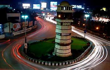
Raipur, Chattisgarh
Raipur is the capital city of the state of Chhattisgarh and its administrative headquarters are located at Raipur District. It was previously a part of Madhya Pradesh before the state of Chhattisgarh was formed on November 1, 2000. A World Class City Naya Raipur is gradually being developed near Raipur.
Following the ruins of a fort and other structures located on the southern part of the city, some historians believe that the city of Raipur was in existence even during the 9th century. King Brahmadeva Rai probably founded the city in the last quarter of the 14th century. This district was once part of Southern Kosal and considered to be under Maurya Kingdom. Raipur city had been the capital of the Haihaya Kings, boasting the traditional forts of the Chhattisgarh for a long time. The town of Raipur has been in existence since the 9th century, the old city and ruins of the fort can be seen in the southern part of the city. Satawahana Kings ruled this part of the kingdom till the 2nd-3rd century AD. Later on Somavanshi kings had taken the control over this region and ruled with Sirpur (Sripur-The city of Wealth) as their capital city. Mahashivgupt Balarjun was the mightiest emperor of this Dynasty. The old inscriptions of Ratanpur, Rajim and Khallari refer to the reign of later kalchuri kings. It is believed that the King Ramachandra of this dynasty established the city of Raipur and subsequently made it the capital of his kingdom.
The new city of Raipur is located near the center of a large plain, which is sometimes referred as the "rice bowl of India", where hundreds of varieties of rice are grown. The Mahanadi River flows to the east of the city of Raipur, and the southern side of the city has dense forests. The Maikal Hills are located on the northwest of Raipur; on the north, the land rises and merges with the Chota Nagpur Plateau that extends northeast across Jharkhand state. On the south of Raipur lies the Baster Plateau. Raipur has a sub-tropical climate with moderate temperatures throughout the year, apart from the summer from March to June, which can be extremely hot approx 45°C. The city receives about 1300 mm of rain, mostly in the monsoon season from late June to early October. Winters last from November to January and are mild.
Raipur city is well connected via rail, road, and air transport services. The city is situated on the Mumbai-Howrah route of Indian Railways and is well connected with such important cities of India. Air links to the city were revived after the city became the state capital. Indian Airlines connects the city with Bhubaneswar, Delhi, Mumbai, Chennai and Nagpur. Raipur City Bus is a road transport system run by Raipur City Transport Services Limited.
Raipur is a commercial city and is referred as "an agricultural-processing and saw-milling town". The city is a regional hub for trade and commerce for a variety of local agricultural and forest products. Several small-scale industries of Raipur include oil milling, soap manufacturing and electrical welding. The conventional face of the city is changing, and the city of Raipur and its neighbourhood are now becoming an important regional commercial and industrial destination for the power, steel and aluminium, coal, industries.
Raipur boasts India`s biggest iron market with about 173 steel rolling mills, 170 sponge iron plants, more than 250 steel plants, 800 agro-industries and 70 ferro-alloy plants in and around the city. Over 300 rice-milling plants, and all major and local cement manufacturing companies are located in the city. Raipur is home to well known names like Indigo Design & Engineering Associates PLC., Soma Developers, DLF, Omaxe, Merlin group and others. Naya Raipur Development Authority is developing the township that will have an 18-hole golf course over 400 acres, golf villas, residential and commercial buildings, and also a luxury hotel.
The demographic composition of Raipur is a mixed one, including North Indians, South Indians, local ethnic Chattisgarhri and a few from North East. The trading communities like Baniyas, Agarwals, Jains, Gujaratis, and Marwaris essentially inhabit the city. The city is also home to an immigrant population that includes Sindhis, Bengalis, Telugu, Malayalees and the Sikhs.
After the formation of the state of Chhattisgarh it was decided that a new capital region should be developed which would be of international standards. For this purpose a new city known as New Raipur is being constructed some 20 Kms from the original city of Raipur. Some of the upcoming projects in this new Raipur include International Cricket Stadium, NIT Raipur, IIIT Raipur and many others.
National Institute of Technology, Pandit Ravi Shankar Shukla University, Indira Gandhi Agriculture University, Hidayatullah National Law University, Kishbhau Thakre Patrakarity Avam Jansanchar Vishwavidyalaya are some of the prominent educational institutions of Raipur. Govt. Model Science College, Central College, Shantiniketan College, Pragati College, Chhattisgarh College, Ayurvedic College and many others cater to the higher education of the city and neighbouring areas. Apart from this Raipur have 9 Engineering colleges. Most of the government-run schools in Raipur are allied with the State School Examination Board, whereas most private schools are allied with Central Board of Secondary Education (CBSE) and Indian Certificate of Secondary Education (ICSE) boards.
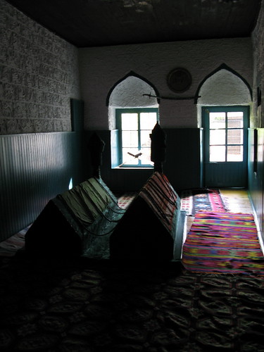
Raipur has Five Radio stations that play music round the clock, namely Radio Mirchi 98.3, My FM 94.3, Rangeela 104.8 FM, National Radio "Vividh Bharti" and Radio Tadka 95.0 FM. Ispat times is a daily-newspaper related to economics and business of Chhattisgarh, published at Raipur. Telibandha Talab is the lake, which lies on the busiest road of the city. Burha Talab is the largest lake in the city. The beautiful lake has an island in the middle, laced with green trees and gardens. Dudhadari Temple is situated near the Burha Talab. This 500-year-old Dudhadari Temple has elaborate carvings and is dedicated to the Hindu God Ram. In Raipur City, one of the most famous temples is known as the Banjari Mata Mandir, which was established by Shree Harish Joshi. Shadani Darbar, located about ten kilometers from Raipur railway station is named after the saint Shri Shadaramji Saheb. It is a popular pilgrimage spot for Hindus.
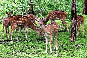
Mahant Ghasi Das Memorial Museum boasts a large collection of inscriptions, images, coins; sculptures and other items are displayed in this museum. Shaheed Smarak Complex is an exceptionally conceptualized architectural marvel of Architect Prasanna Kothari. It is a memorial of freedom fighters enveloping a huge auditorium, library, museum and an art gallery, located in the heart of the city. Nandanvan Garden developed by the wildlife division of the Raipur Forest Department is noted for its natural beauty. It is located about 15 km from Raipur, on the banks of the Kharron River, in the western boundary of Raipur. There is a zoo with animals such as lions, panthers, wild cats and deer, among many others. Raipur is constantly growing and developing into almost a metropolitan city. The residents of Raipur and its neighbouring towns and villages enjoy the facilities available in this city.
 The name Kurukshetra brings to our mind the Puranas and the Mahabharatha`s. The name of the place is associated with the legendary king Kuru. The tribe of Kurus was born as a result of merger of the various classes of the Great Bharatas. It is said that the place bears witness to the composition of Vedic literature.
 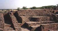 Haryana and in it lies buried the ruins of the capital of the Agroha State. The ancient Agroha town existed some hundred years before the Kushan dynasty. Once the state was renowned for its prosperity. As time passed it could not stand the invasions of Greeks, Yavanas and Hunas. The invasions led to the migration of Agroha residents to other parts of India like Rajasthan, Uttar Pradesh, Punjab and Malwa. They people got the common name Aggarwals that means Agroha-Wale. From the excavations it is clear that below the mounds existed a big, well planned and progressive town. Large number of silver and bronze coins of different shapes and sizes has been discovered from the excavated site. The scripts on the coins prove that they belong to different periods. Statues made of stone and sand was also excavated from the sites. There were many utensils belonging to the 2nd century BC.
  The Agroha Mountain goes back to the 3rd century BC and it is the place where Harappan coins were discovered apart from stone sculptures, terracotta seals, iron and copper implements, shells etc. The Agroha mound consists of the Agroha Temple Complex on one side and the Sheela Mata Temple on the other side.
 The places of tourist interest attract thousands of tourists all round the year. The Maitri Bagh is a zoo and a park established by the Bhilai Steel Plant. Large groups view the colorful musical fountain and the accompanying show during the evenings. Indira Place and Akash Ganga are the best places for shopping in Bhilai. Venktesh (Supela), Chandra & Maurya (G.E.Road Supela), Basant (Camp), Krisna (Risali) and Sapna (Power House) are some of the best theatres of Bhilai. Deobalod is situated about 3 km from Bhilai and is famous for Oldest Shiv Mandir. Tandula is 60 km away from the district of Durg and is famous for Dam on the river Tandula. This exciting picnic spot offers great accommodation at the rest house of irrigation department. Dhamdha is situated on the Durg-Bemetara road 35 km from the district of Durg. It is famous for Prachin Kila (Oldest Palace) and Mandir. Balod is famous for Prachin Kila (Oldest Palace), Mandir (Temples) and Sati Chabutra. Siyadevi in Bhilai is famous for Sita Maiya`s temple, situated in the heart of greenery of natural jungle.


 A municipality has been set up in order to supervise the administration of Kirandul. Over the years a multitude of demographers have conducted surveys and research works, which throw some light on the demographical scenario of Kirandul. In this regard , the Census report that has been brought out in the year 2001 is significant. According to this report, the total population of Kirandul has been enumerated to be 19,053. Not only that, one can also get to identify the status of males and females. Out of it , male populace constitutes 52 . The population of females is only 48 percent. As far as the children of Kirandul are concerned, 11% of the population is below six years of age.
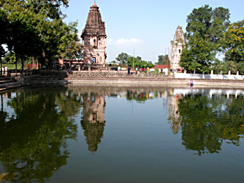


 Losar the Tibetan Buddhist festival celebrated in the month of February–March every year
  popularly called Meera Lama. The name of Tawang means "horse chosen," a reference to the way in which Meera Lama`s horse wandered off on its own and discovered the perfect spot on which the monastery now stands.
 Tawang is an important centre of Buddhist learning and is particularly famous for its 400 year old gompa, one of the best known in India. The Tawang Gompa houses a beautifully gilded 8 metre high statue of the Buddha and a number of equally remarkable idols, thangkas and murals.

 sculptures belong to 14 -15 century , the more important being Indra on Airavat, Surya on Chariot and huge Nandi bull. The temple dedicated to Goddess Durga at Malinithan is built on the classical tradition of Orissa.
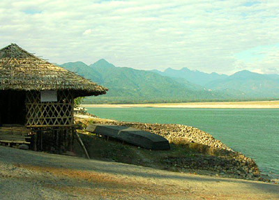 Watching the scenic splendours at Pasighat in Arunachal Pradesh is worth a life time. Pasighat is one of Arunachal`s oldest town and also the district headquarters of East Siang. The turbulent Siang River races across the district heading for the plains where it is met by the Dihing and Lohit rivers after which the rivers roar into Assam as the mighty Brahmaputra.
 Picturesque Ziro is 200 km from Itanagar in Arunachal Pradesh. Situated on the Apatani Plateau (in the lower Subansiri region) and surrounded by pine mantled hills all around, it is spectacular. Well connected by bus to Daporijo (home of the Tagin and Miri tribes) the district headquarters of upper Subansiri, it`s a tourist`s delight with its dazzling landscapes and tribal culture. Make a point to visit Tarin, the high-altitude fish farm, the famous whispering pine grove and the craft centre. From a hilltop, catch the first rays of dawn lighting up the stunning emerald patchwork quilt of nature.