Kadamakkudy, Ernakulam, Kerala
Quite a handful of town and places have developed by leaps and bounds in each and every state of Indian Territory. In the state of Kerala also there is no dearth of towns and cities as such. Amongst them, one can easily point out Kadamakkudy to be quite significant. Kadamakkudy is a census town. In the same state, this town is situated in the district of Ernakulam.
There are several demographers that have thrown some light on the demographical scenario of the Kadamakkudy town. In this regard, the Census report of India that has been published in the year 2001 deserves mentioning. Important data about the Kadamakkudy town like population, literacy etc can be deciphered from it. According to the report, the Kadamakkudy town has got a population of 15,823. Out of the total population of Kadamakkudy, males comprise of 49 percent, while the population of females is 51 percent. In Kadamakkudy town , 11 percent of the total population is below six years of age.
As far as the average literacy rate of Kadamakkudy is concerned, it has been derived that the average literacy rate is 84 percent. It is higher than the average literacy rate of India, which has been measured to be 59.5 percent. To be specific, rate of male literacy is 86 percent and female literacy rate is 82 percent. Just like many other districts of India, agriculture has become the important occupation of most of the people of the Kannur district.
Research has shown that out of the total 235319 hectares of land, crops are being produced in 210438 hectares. Among several production, coconut is the major one . Other crops like rubber, paddy, and tapioca also are grown in the district . A paddy cultivation system , popularly called pokkali is quite unique to the district. The people of Kadamakkudy also have followed this trend.
Monday, December 31, 2012
Elayavoor, Kerala
Elayavoor, Kerala
Elayavoor is a census town in Kannur district of the southern state of India, Kerala.
According to the 2001 India census report, Elayavoor had a population of 31,545 inhabitants. Males constitute 47% of the population while the females constitute 53% of the population. Ten percent of the population is less than six years of age in Elayavoor. The average literacy rate of this town is 86%, which is higher than the national average literacy rate, which is 59.5%. The male literacy rate is 87% while the female literacy rate is 85%.
| |
Thrissur, Kerala
Thrissur, Kerala'
The city Thrissur is the head quarter of Thrissur district of Indian state Kerala. It is famous for its number of temples. It is also called as Trichur. The name Thrissur derived from Thiru- Shiva-Perur, which literary translates to "The city with the name of the Sacred Shiva". In ancient days this city was called Vrishabhadripuram and then Kailasam.
History
Thrissur was the capital of Kochi kingdom. The city gained prominence under the region of Raja Rama Verma who was referred as the Maharaja Shakthan Thampuran, in the year 1790. Shakthan Tampuran had rebuilt the city Thissur, after the attacks of Tipu Sultan`s army. Thrissur city has played a significant part in the history of South India. In the year 1919, a committee of the Indian National Congress was functioning in Thrissur.
 Geography
Thrissur is situated in southwestern India at 10.52°N, 76.21°E and it is located at the center place of Kerala. Thrissur is at sea level and spans an area about 66.15 sq. km. The city enjoys the tropical climate. The maximum temperature in summer is 35°C, minimum 22.5°C and in winter maximum temperature is 32.3°C and minimum is 20.5°C.
Economy
Thrissur can also be reffered as the golden city of India. It is one of the main manufacturing centers of plain gold jewellery in the south India. Thrissur is also the head quarter of three major scheduled banks , South Indian bank, Catholic Syrian Bank and Dhanalakshmi Bank Ltd. the other industries of Thrissur are diamond polishing and tyre moulding.
Government
The corporation of the Thrissur was established on 30th September 2000. The city Mayor is responsible for all the maintenances of the city.
Transport
By Air- Kochi International Airport is the nearest airport of Thrissur.
By Rail- Thrissur Railway Station is on the artery of the railway line that connects the southern part of the Kerala with the rest of India.
By Road- National Highway NH-47 is well connected the city. It has frequent bus services to different cities near by it.
Demographics
As per 2001 Census, Thrissur had a population of 2,975,440. Males constitute 49% and females constitute 51% of the total population.10% is coming under six year of age. Thrissur has an average literacy rate of 865, which is higher than the national average of 59.5%. male literacy rate is 87% where as female literacy rate is 86% in the city.
Culture
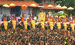 The main language of Thrissur is Malayalam, followed by Tamil, English and Hindi. The major cultural attraction is the Thrissur Pooram Festival, celebrated during April- May. Elephant carries the ceremonial umbrellas to the deity. This festival was introduced by Shakthan Thampuran, the Maharaja of the Kochi state. Pooram festival is also well known for magnificent display of fire works.
Another festival is Puli kali, which is celebrated on the fourth day of Onam. It is procession different clubs from all over the city. Everyone painted themselves as tiger and dance around the city.
Kerala Sahitya Academy, Sangeetha Natak Academy and Kerala Lalithkala Academy are head quartered at Thrissur making the epithet `cultural capital of Kerala` more meaningful. Kerala is the birthplace of the Indian Coffee House movement (ICH). The first ICH owned by its employees of the state opened in Thrissur in 1957. From last few years, city has been hosting the international Film Festival of Thrissur.
Visiting places of Thrissur.
Annakayam - This place is famous for its cool and placid watery lake.
 Art museum- This museum is famous for its good collection of woods cravings metal sculptures, Kathakali figures and ancient jewellery.
Athirapally and Vazhachal Water Falls- East of Chalakudy, near the entrance to the Sholayar forest ranges these two beautiful waterfalls are situated. These waterfalls are placed at 80 feet high.
Guruvayur- This is a very good pilgrimage place, 32 km distant from Thrissur. It is known as Dwaraka of South. The Shree Krishna Swamy Temple, which attracts thousand of visitors. Legends say that, this temple was created before 16th century and created by Guru, the preceptor of Devdas and Vayu, the Lord of winds.The temple is dedicated to Krishna known here as Guruvayurappan or the Lord Guruvayur.
Cheruthuruthy- This place is 29 kilometer away from Thrissur. It is a famous training institution of music, drama and dance of Kathakali, Mohiniyattam, and Koodiyattam.
 Peechi Dam- Peechi Dam, 23 km from Thrissur is an irrigation project site, which offers boating facilities. There is also a wild life sanctuary available near the Dam.
Punnathur Kotta- Punnathur Kotta is the place of elephants. Here the elephants are taken care, which is now days used as a visiting site.
Zoo- The city zoo is 2 kilometer from Thrissur town. It acquires the total area of 13.5 acres. Various animals are kept under care here.
Education
Thrissur is also called as the educational capital of Kerala. There are number of schools and colleges are established, including St. Thomas College, Sri Kerala Verma College, St. Mary`s College, Vimala College. The other famous Institutions are Govt. Medical College Thrissur, Jubilee Mission Medical College, Amala Medical college, Govt. Engineering College, Govt. Law College, Ayurveda College, Govt. Fine Arts College, College of cooperation and Banking, College of Horticulture, College of Forestry. Besides all these famous Institutions, one Agricultural university of Thrissur is also present in this city.
Media
The first newspaper of Thrissur is Lokmanya. Published in the year 1920. Now the leading newspapers in Malayalam are Malaya Manorama, Express, Matrubhumi, Desabhimani, Kerala kaumudi, Deepika and Madhyamam.
The city Thrissur is the head quarter of Thrissur district of Indian state Kerala. It is famous for its number of temples. It is also called as Trichur. The name Thrissur derived from Thiru- Shiva-Perur, which literary translates to "The city with the name of the Sacred Shiva". In ancient days this city was called Vrishabhadripuram and then Kailasam.
History
Thrissur was the capital of Kochi kingdom. The city gained prominence under the region of Raja Rama Verma who was referred as the Maharaja Shakthan Thampuran, in the year 1790. Shakthan Tampuran had rebuilt the city Thissur, after the attacks of Tipu Sultan`s army. Thrissur city has played a significant part in the history of South India. In the year 1919, a committee of the Indian National Congress was functioning in Thrissur.
GeographyThrissur is situated in southwestern India at 10.52°N, 76.21°E and it is located at the center place of Kerala. Thrissur is at sea level and spans an area about 66.15 sq. km. The city enjoys the tropical climate. The maximum temperature in summer is 35°C, minimum 22.5°C and in winter maximum temperature is 32.3°C and minimum is 20.5°C.
Economy
Thrissur can also be reffered as the golden city of India. It is one of the main manufacturing centers of plain gold jewellery in the south India. Thrissur is also the head quarter of three major scheduled banks , South Indian bank, Catholic Syrian Bank and Dhanalakshmi Bank Ltd. the other industries of Thrissur are diamond polishing and tyre moulding.
Government
The corporation of the Thrissur was established on 30th September 2000. The city Mayor is responsible for all the maintenances of the city.
Transport
By Air- Kochi International Airport is the nearest airport of Thrissur.
By Rail- Thrissur Railway Station is on the artery of the railway line that connects the southern part of the Kerala with the rest of India.
By Road- National Highway NH-47 is well connected the city. It has frequent bus services to different cities near by it.
Demographics
As per 2001 Census, Thrissur had a population of 2,975,440. Males constitute 49% and females constitute 51% of the total population.10% is coming under six year of age. Thrissur has an average literacy rate of 865, which is higher than the national average of 59.5%. male literacy rate is 87% where as female literacy rate is 86% in the city.
Culture
The main language of Thrissur is Malayalam, followed by Tamil, English and Hindi. The major cultural attraction is the Thrissur Pooram Festival, celebrated during April- May. Elephant carries the ceremonial umbrellas to the deity. This festival was introduced by Shakthan Thampuran, the Maharaja of the Kochi state. Pooram festival is also well known for magnificent display of fire works. Another festival is Puli kali, which is celebrated on the fourth day of Onam. It is procession different clubs from all over the city. Everyone painted themselves as tiger and dance around the city.
Kerala Sahitya Academy, Sangeetha Natak Academy and Kerala Lalithkala Academy are head quartered at Thrissur making the epithet `cultural capital of Kerala` more meaningful. Kerala is the birthplace of the Indian Coffee House movement (ICH). The first ICH owned by its employees of the state opened in Thrissur in 1957. From last few years, city has been hosting the international Film Festival of Thrissur.
Visiting places of Thrissur.
Annakayam - This place is famous for its cool and placid watery lake.
Art museum- This museum is famous for its good collection of woods cravings metal sculptures, Kathakali figures and ancient jewellery.Athirapally and Vazhachal Water Falls- East of Chalakudy, near the entrance to the Sholayar forest ranges these two beautiful waterfalls are situated. These waterfalls are placed at 80 feet high.
Guruvayur- This is a very good pilgrimage place, 32 km distant from Thrissur. It is known as Dwaraka of South. The Shree Krishna Swamy Temple, which attracts thousand of visitors. Legends say that, this temple was created before 16th century and created by Guru, the preceptor of Devdas and Vayu, the Lord of winds.The temple is dedicated to Krishna known here as Guruvayurappan or the Lord Guruvayur.
Cheruthuruthy- This place is 29 kilometer away from Thrissur. It is a famous training institution of music, drama and dance of Kathakali, Mohiniyattam, and Koodiyattam.
Peechi Dam- Peechi Dam, 23 km from Thrissur is an irrigation project site, which offers boating facilities. There is also a wild life sanctuary available near the Dam. Punnathur Kotta- Punnathur Kotta is the place of elephants. Here the elephants are taken care, which is now days used as a visiting site.
Zoo- The city zoo is 2 kilometer from Thrissur town. It acquires the total area of 13.5 acres. Various animals are kept under care here.
Education
Thrissur is also called as the educational capital of Kerala. There are number of schools and colleges are established, including St. Thomas College, Sri Kerala Verma College, St. Mary`s College, Vimala College. The other famous Institutions are Govt. Medical College Thrissur, Jubilee Mission Medical College, Amala Medical college, Govt. Engineering College, Govt. Law College, Ayurveda College, Govt. Fine Arts College, College of cooperation and Banking, College of Horticulture, College of Forestry. Besides all these famous Institutions, one Agricultural university of Thrissur is also present in this city.
Media
The first newspaper of Thrissur is Lokmanya. Published in the year 1920. Now the leading newspapers in Malayalam are Malaya Manorama, Express, Matrubhumi, Desabhimani, Kerala kaumudi, Deepika and Madhyamam.
Kovalam, Kerala
Kovalam, Kerala
Kovalam, a small town located 16km from Thiruvanathapuram is famous for its beautiful beaches. Its sandy beaches are lined with palm-fringed lagoons and rocky coves. Kovalam with its unique and wonderful beaches is a sheltered bay and is endowed with unusual natural beauty. The Arabian sea coast at many places is lined with beautiful patches of coral reefs. An hours drive from the capital, it is the most famous south Indian beach, popular for sunbathing.
It was during the 1930`s, that the potentiality of Kovalam beach as a tourist destination was discovered by the European guests of the then `Travancore` kingdom. But the real fame as an ideal beach resort was won later for the Kovalam beach in the early seventies with the arrival of masses of `Hippys`. In the seventies Kovalam became a hippy idyll, a fishing village providing fresh fish, fruit and toddy (coconut bear) nestling a picture perfect tropical beach. Later it developed into a laid back tourist hangout with a few basic but comfortable lodges and makeshift restaurants. But today this tiny beach is ferrying thousands of tourists from all around the world and has a wide range of accommodation for the budget as well as luxury tourists.
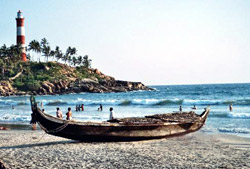 Kovalam consists of three adjacent coconut palm fringed crescent beaches separated by rocky promontories. The southern most beach, marked by a prominent red and white striped Light House, known as the Light house beach, is the most popular of the three. It is lined with cafes/restaurants serving delicious seafood especially prawns and lobsters, bars and vendors selling clothes, crafts, carpets, fruits etc. Further south beyond the light house, is the small village of Vizhinjam. Vizhinjam, scarcely visited by tourists is a major centre for fishing. It has a beach of its own.
The northernmost beach is the Samudra, dotted with traditional fishing boats and is least affected by the changing times. In between lies the Hawah or the Eve`s beach. North of the Eve`s beach on a rocky promontory lies the award winning resort, the Ashoka beach resort which divide the beaches into north and south sections. The resort has its own small section of private beach and provides windsurfing and sailing boat facilities. Its a 15min. walk between the Ashoka and the Light house.
 The beaches are generally safe and clean. The best season is from December to March. There are life guard patrols on the beach, but you still need to be careful when swimming. It is safest to swim between the flags in the area patrolled by the life guards. Besides swimming and sunbathing, the natural bay is ideal for kayaking, surfing and skiing. Surfboards and boogie boards can be hired on the Kovalam beach. Marine Angling for deep-sea fishing is also available at the beach. The sunrise and sun set cruises in country rafts or on logs of lashed woods on catamarans, provided by local fishermen are quite popular.
Beyond the season from between April and October the powerful Arabian Sea can roughen with swells of up to 6m. From May the sea level rises removing the beach completely in places and swimming can become very dangerous.
Kovalam is also a centre for the traditional Ayurvedic treatment. Many hotels offer complete health and revitalization packages. Apart from Oil massages, intensive treatments that last up to 21 days including special diet`s and daily massages are offered. Yoga schools offering meditation and yoga classes, are also plenty in and around Kovalam beach. Cultural programmes at the beach include performances of the traditional Kerala art form, Kathakali and ethnic martial art, Kalarippayattu.
Kovalam, a small town located 16km from Thiruvanathapuram is famous for its beautiful beaches. Its sandy beaches are lined with palm-fringed lagoons and rocky coves. Kovalam with its unique and wonderful beaches is a sheltered bay and is endowed with unusual natural beauty. The Arabian sea coast at many places is lined with beautiful patches of coral reefs. An hours drive from the capital, it is the most famous south Indian beach, popular for sunbathing.
It was during the 1930`s, that the potentiality of Kovalam beach as a tourist destination was discovered by the European guests of the then `Travancore` kingdom. But the real fame as an ideal beach resort was won later for the Kovalam beach in the early seventies with the arrival of masses of `Hippys`. In the seventies Kovalam became a hippy idyll, a fishing village providing fresh fish, fruit and toddy (coconut bear) nestling a picture perfect tropical beach. Later it developed into a laid back tourist hangout with a few basic but comfortable lodges and makeshift restaurants. But today this tiny beach is ferrying thousands of tourists from all around the world and has a wide range of accommodation for the budget as well as luxury tourists.
Kovalam consists of three adjacent coconut palm fringed crescent beaches separated by rocky promontories. The southern most beach, marked by a prominent red and white striped Light House, known as the Light house beach, is the most popular of the three. It is lined with cafes/restaurants serving delicious seafood especially prawns and lobsters, bars and vendors selling clothes, crafts, carpets, fruits etc. Further south beyond the light house, is the small village of Vizhinjam. Vizhinjam, scarcely visited by tourists is a major centre for fishing. It has a beach of its own. The northernmost beach is the Samudra, dotted with traditional fishing boats and is least affected by the changing times. In between lies the Hawah or the Eve`s beach. North of the Eve`s beach on a rocky promontory lies the award winning resort, the Ashoka beach resort which divide the beaches into north and south sections. The resort has its own small section of private beach and provides windsurfing and sailing boat facilities. Its a 15min. walk between the Ashoka and the Light house.
The beaches are generally safe and clean. The best season is from December to March. There are life guard patrols on the beach, but you still need to be careful when swimming. It is safest to swim between the flags in the area patrolled by the life guards. Besides swimming and sunbathing, the natural bay is ideal for kayaking, surfing and skiing. Surfboards and boogie boards can be hired on the Kovalam beach. Marine Angling for deep-sea fishing is also available at the beach. The sunrise and sun set cruises in country rafts or on logs of lashed woods on catamarans, provided by local fishermen are quite popular. Beyond the season from between April and October the powerful Arabian Sea can roughen with swells of up to 6m. From May the sea level rises removing the beach completely in places and swimming can become very dangerous.
Kovalam is also a centre for the traditional Ayurvedic treatment. Many hotels offer complete health and revitalization packages. Apart from Oil massages, intensive treatments that last up to 21 days including special diet`s and daily massages are offered. Yoga schools offering meditation and yoga classes, are also plenty in and around Kovalam beach. Cultural programmes at the beach include performances of the traditional Kerala art form, Kathakali and ethnic martial art, Kalarippayattu.
Mahe, Kerala
Mahe, Kerala
Mahe is a tiny point in the Geographical map of Kerela, the million earner for the distant Pondicherry Government, 647 kms away from Pondicherry. In this former small French Town which covers an area of 9 Sq. kms , over 36,000 inhabitants live in peace.
On examination of the history of Kerala no concrete evidence is available mentioning the place ‘Mahe’ other wise called by the natives "Mayyazhi". It is only after the settlement of the French, the name Mahe (Mayyazhi) got a place in the geographical map of India.
St Theresa Church
It lies on the Main Road. The most famous Christian Church in Malabar. The Church was built during French Reign and it stands as a monument to the legacy of French rule. The festival is celebrated from 5th to 22nd October every year and the important dates are 14th and 15th. It is a festival of Mahe irrespective of religion or caste. For the entire people of Mahe consider this church as their own. The people all over Kerela and from neighboring Districts of Karnataka come and visit the church during this festival.
Once, as the legend goes, a ship was sailing through the Arabian sea in Malabar. When it reached the horizon of Mahe, the ship got stuck up. The Captain of the ship after a prolonged effort to move it, found, to his surprise, a statue of ST.Theresa which he brought to the shore where he constructed a place for erecting this statue. It is only after this, that, as the myth has it, the ship could sail again.In course of time, that place became the famous church.
Puthalam Forts
 The Puthalam festival takes place in the 1st fortnight of every March. It is during this period of festival that the Theyyam gets enacted.
Theyyattam or Thirayattam is the most famous ritual art of North Kerala which is a combination of art craft, choreography, painting, dancing, acting and singing. Puthalam is famous for its ancient temple and kuttichathan, the God, another incarnation of Vishnu.
Othenan`s Fort
Remnants of this castle may be seen just at the corner of the Kozhikode Kannur National Highway near the Mini Civil Station. This is believed to have been built by Thatcholi Othenan, a widely known folk-lore hero who became the Robin hood of North Malabar.
St.George Fort
Situated on the highest hill of Cherukallayi one kilometer from Mahe. The French constructed a Fort here and the ruminants could now be seen. You may have a panoramic view of Mahe from here.
It is near this fort, that the TV. Relay station of Mahe has been built.
Payyambalam Beach
 Payyambalam is the beach of Kannur town. It is long and clean. Flat laterite cliffs just into the sea at one end. Picturesque and incredibly beautiful. The Naura cafeteria and the well laid out gardens greet the vistors to Payyambalam. The beach is only walking distance from Fort St.Angelo. Veteran freedom fighters like A.K.G, Swadeshabimani, Chirakkal T etc were cremated here.
Muzhappilangad Beach
Muzhappilangad is 14kms from Mahe. A long clean beach, its enchanting ambience invites you to swim. sunbathe or just lounge around. Black rocks protect Muzhappilangad from the currents from the deep, making its shallow water a swimmers paradise. Muzhappilangad is Kerala`s only drive in beach which is about 5kms long. From Muzhappilangad you can see the Dharmadam island (Pacha Thuruth) just across the Arayakkandy river, a remarkable conjunction of beach and island.
 Gundert Bungalow
It lies near Tellicherry town on the National highway at Illikunnu. Dr.Herman Gundert, the reverent German priest, researcher and scholar lived in this bunglow for 20 years from 1839 and produced the first Malayalam Dictionary, first Malayalam news paper `Paschimodayam` etc.
Overburys Folly
Walk able distance from Thalassery town, a sea view site surrounded by the Sai gym, Thalassery Stadium, Thalassery Fort and the Arabian sea. The beautifully constructed and arranged palace which is perfect for a silent evening. Recently renovated site includes an open air stage. This is a show of perfect architectural art.
Dharmadam Island
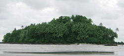 A small island full of coconut palms and green bush extending to 5 acres. 100 meters away from the main land at Dharmadam. The island (private land) is a beautiful sight from the beach. Permission is required to enter into the island from its owners. It is located 15 kms away from Mahe.
Pazhassi Dam
An ideal retreat for tourists, it lies 50 km from Mahe near Mattannur. Magnificent picturesque scenes are found here. Pleasure boating facilities are being provided by DTPC in the reservoir. Accommodation available in the project inspection Bungalow and dormitories.
Malayala Kalagramam
It is situated near the Mahe bridge. Connoisseurs can find the Malayala Kalagramam as a renowned center for arts and ideas. It houses the only Art gallery in Kannur. Courses in painting, sculpture, music, dance and pottery are offered.
Mahe is a tiny point in the Geographical map of Kerela, the million earner for the distant Pondicherry Government, 647 kms away from Pondicherry. In this former small French Town which covers an area of 9 Sq. kms , over 36,000 inhabitants live in peace.
On examination of the history of Kerala no concrete evidence is available mentioning the place ‘Mahe’ other wise called by the natives "Mayyazhi". It is only after the settlement of the French, the name Mahe (Mayyazhi) got a place in the geographical map of India.
St Theresa Church
It lies on the Main Road. The most famous Christian Church in Malabar. The Church was built during French Reign and it stands as a monument to the legacy of French rule. The festival is celebrated from 5th to 22nd October every year and the important dates are 14th and 15th. It is a festival of Mahe irrespective of religion or caste. For the entire people of Mahe consider this church as their own. The people all over Kerela and from neighboring Districts of Karnataka come and visit the church during this festival.
Once, as the legend goes, a ship was sailing through the Arabian sea in Malabar. When it reached the horizon of Mahe, the ship got stuck up. The Captain of the ship after a prolonged effort to move it, found, to his surprise, a statue of ST.Theresa which he brought to the shore where he constructed a place for erecting this statue. It is only after this, that, as the myth has it, the ship could sail again.In course of time, that place became the famous church.
Puthalam Forts
The Puthalam festival takes place in the 1st fortnight of every March. It is during this period of festival that the Theyyam gets enacted. Theyyattam or Thirayattam is the most famous ritual art of North Kerala which is a combination of art craft, choreography, painting, dancing, acting and singing. Puthalam is famous for its ancient temple and kuttichathan, the God, another incarnation of Vishnu.
Othenan`s Fort
Remnants of this castle may be seen just at the corner of the Kozhikode Kannur National Highway near the Mini Civil Station. This is believed to have been built by Thatcholi Othenan, a widely known folk-lore hero who became the Robin hood of North Malabar.
St.George Fort
Situated on the highest hill of Cherukallayi one kilometer from Mahe. The French constructed a Fort here and the ruminants could now be seen. You may have a panoramic view of Mahe from here.
It is near this fort, that the TV. Relay station of Mahe has been built.
Payyambalam Beach
Payyambalam is the beach of Kannur town. It is long and clean. Flat laterite cliffs just into the sea at one end. Picturesque and incredibly beautiful. The Naura cafeteria and the well laid out gardens greet the vistors to Payyambalam. The beach is only walking distance from Fort St.Angelo. Veteran freedom fighters like A.K.G, Swadeshabimani, Chirakkal T etc were cremated here.Muzhappilangad Beach
Muzhappilangad is 14kms from Mahe. A long clean beach, its enchanting ambience invites you to swim. sunbathe or just lounge around. Black rocks protect Muzhappilangad from the currents from the deep, making its shallow water a swimmers paradise. Muzhappilangad is Kerala`s only drive in beach which is about 5kms long. From Muzhappilangad you can see the Dharmadam island (Pacha Thuruth) just across the Arayakkandy river, a remarkable conjunction of beach and island.
Gundert BungalowIt lies near Tellicherry town on the National highway at Illikunnu. Dr.Herman Gundert, the reverent German priest, researcher and scholar lived in this bunglow for 20 years from 1839 and produced the first Malayalam Dictionary, first Malayalam news paper `Paschimodayam` etc.
Overburys Folly
Walk able distance from Thalassery town, a sea view site surrounded by the Sai gym, Thalassery Stadium, Thalassery Fort and the Arabian sea. The beautifully constructed and arranged palace which is perfect for a silent evening. Recently renovated site includes an open air stage. This is a show of perfect architectural art.
Dharmadam Island
A small island full of coconut palms and green bush extending to 5 acres. 100 meters away from the main land at Dharmadam. The island (private land) is a beautiful sight from the beach. Permission is required to enter into the island from its owners. It is located 15 kms away from Mahe.Pazhassi Dam
An ideal retreat for tourists, it lies 50 km from Mahe near Mattannur. Magnificent picturesque scenes are found here. Pleasure boating facilities are being provided by DTPC in the reservoir. Accommodation available in the project inspection Bungalow and dormitories.
Malayala Kalagramam
It is situated near the Mahe bridge. Connoisseurs can find the Malayala Kalagramam as a renowned center for arts and ideas. It houses the only Art gallery in Kannur. Courses in painting, sculpture, music, dance and pottery are offered.
Kollam Tour, Kerala
Kollam Tour, Kerala
72 km off Thiruvananthapuram,Kollam is a trade-nerve in Southern Kerala. Its trading-tradition dates back to early centuries when Chinese, Greeks, Arabs and Romans haunted the shore for ship-loading Kerala spices and produces. Today Kollam is the major cashew trading and processing centre in the country. Also a hub of marine industry.
Alumkadavu
A traditional boat-building centre.
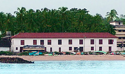
Thankassery Light House
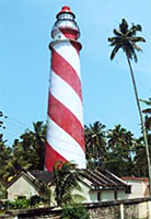 Century-old light house at Thankassery beach. Remains of colonial culture are visible. Anglo-Indian families are concentrated here.
Neendakara
A major fishing harbour in Kerala. Centre of Indo-Norwegian Fisheries Community Project, since 1953.
Sasthamkotta
The biggest freshwater lake in Kerala and picturesque Sasthamkotta temple.
72 km off Thiruvananthapuram,Kollam is a trade-nerve in Southern Kerala. Its trading-tradition dates back to early centuries when Chinese, Greeks, Arabs and Romans haunted the shore for ship-loading Kerala spices and produces. Today Kollam is the major cashew trading and processing centre in the country. Also a hub of marine industry.
Alumkadavu
A traditional boat-building centre.
Thankassery Light House
Century-old light house at Thankassery beach. Remains of colonial culture are visible. Anglo-Indian families are concentrated here. Neendakara
A major fishing harbour in Kerala. Centre of Indo-Norwegian Fisheries Community Project, since 1953.
Sasthamkotta
The biggest freshwater lake in Kerala and picturesque Sasthamkotta temple.
Sunday, December 30, 2012
Kannur Cantonment , Kerala
Kannur Cantonment , Kerala
]
Kannur Cantonment in Kerala has a rich heritage of history. In the annuls of Indian history, this Kannur Cantonment is the `Headquarters of Defence Security Corps`. Here also majority of Anglo Indian have built their settlements. Kannur Cantonment also became popular as Burnassery. It is the ideal destination for devotees of all religions. Several Christian churches, one mosque for Muslim community is significant. In the neighborhood one also can find a temple, which is quite popular amongst the Hindu pilgrims.
The census report of Kannur Cantonment has been enumerated to be 4699. Out of it, male populace comprises of 65 percent while the populace of females comprises of 35 percent. Literacy rate acts as added information about Kannur Cantonment. From it, one also can derive the fact that the average literacy rate of Kannur Cantonment is higher than that of the entire nation. In other words, 89 percent and 59.5 percent are the rates of average literacy of Kannur Cantonment and India. On individual level also, the literacy rates of males and females are quite high. Male literacy constitutes of 92 percent. Also the rate of female literacy is no less significant constituting 84 percent of the total population of Kannur Cantonment. Also the children who are below six years of age constitutes of 8 percent of the total population of Kannur Cantonment in Kerala.
Educational propensity of the people is quite evident from the number of Anglo Indian schools that have flourished in Kannur Cantonment and its neighborhood. These include `St Therasa`s A I HSS Burnassery` ; `St Michael`s A I HSS Kannur`; Ursaline Convent School, B E M P Upper Primary School, St Peter`s Lower Primary School. Very recently a Premier English School has been set
Kannur Cantonment , Kerala
Kannur Cantonment , Kerala
]
Kannur Cantonment in Kerala has a rich heritage of history. In the annuls of Indian history, this Kannur Cantonment is the `Headquarters of Defence Security Corps`. Here also majority of Anglo Indian have built their settlements. Kannur Cantonment also became popular as Burnassery. It is the ideal destination for devotees of all religions. Several Christian churches, one mosque for Muslim community is significant. In the neighborhood one also can find a temple, which is quite popular amongst the Hindu pilgrims.
The census report of Kannur Cantonment has been enumerated to be 4699. Out of it, male populace comprises of 65 percent while the populace of females comprises of 35 percent. Literacy rate acts as added information about Kannur Cantonment. From it, one also can derive the fact that the average literacy rate of Kannur Cantonment is higher than that of the entire nation. In other words, 89 percent and 59.5 percent are the rates of average literacy of Kannur Cantonment and India. On individual level also, the literacy rates of males and females are quite high. Male literacy constitutes of 92 percent. Also the rate of female literacy is no less significant constituting 84 percent of the total population of Kannur Cantonment. Also the children who are below six years of age constitutes of 8 percent of the total population of Kannur Cantonment in Kerala.
Educational propensity of the people is quite evident from the number of Anglo Indian schools that have flourished in Kannur Cantonment and its neighborhood. These include `St Therasa`s A I HSS Burnassery` ; `St Michael`s A I HSS Kannur`; Ursaline Convent School, B E M P Upper Primary School, St Peter`s Lower Primary School. Very recently a Premier English School has been set
Edathala, Ernamulam, Kerala

Edathala is a census town in Ernakulam district of the southern state of India, Kerala. Chunangamvely is a famous village near Edathala.
As per the 2001 Indian census report; Edathala had a population of 67,137 inhabitants. In Edathala, 11% of the population is less than six years of age. Edathala has an average literacy rate of 80%, which is much higher than the national average literacy rate of 59.5%. The male literacy rate is 83% while the female literacy rate is 77%.
Cheruvannur, Kozhikode, Kerala
Cheruvannur, Kozhikode, Kerala
Cheruvannur is a census town situated in the Kozhikode district in the state of Kerala in India.
According to the 2001 census, the population of the town is 57,111 inclusive of 49% males, 51% females and 13% children less than 6 years of age. With a male literacy of 84% and female literacy of 80%, the average literacy rate of the town amounts to 82%. This is higher than the national average of 59.5%. This region was a part of Parappanad which was a kingdom ruled by a kshatriya family.
Kureekkad, Ernakulam, Kerala
Kureekkad, Ernakulam, Kerala

Over the years several demographers have devoted much of their time and energy in order to throw some light on the demographical scenario of this Kureekkad town. After conducting a multitude of survey and research works in this region, they have been successful in bringing about some relevant data about its demography. In this regard, it would be unwise if one does not mention about the Census report that has been published in the year 2001. It is truly a vital document which highlights the status of population , literacy condition of this Kureekkad town in Kerala .
According to this report, the total population of Kureekkad in Kerala showed a counting of 9730. A remarkable thing has been noticed about this Kureekkad town in Kerala. Interestingly, number of females in Kureekkad of Kerala is more than males. 49 percent constitutes of male populace, while female population constitutes of 51 percent. In Kureekkad status of children too can be deciphered. Thus in Kureekkad children below six years of age constitutes of 10 percent of the total population.
Literacy rate too acts a yardstick for measuring the growth and development of a town. It is remarkable to find out that the average literacy rate is much higher than that of the entire nation which has been measured to be 59.5 percent. Comparison to that, the average literacy rate of Kureekkad is 86 percent . Also the difference in percentage rate of male and female literacy is also less. In other words , male literacy rate constitutes of 87. Female literacy rate is 85 percent.
Marathakkara, Thrissur, Kerala
Marathakkara, Thrissur, Kerala
Marathakkara is a `census town` located in the Thrissur district of the southern state of India, Kerala. The cultural city of Kerala, Thrissur is located 10 km. from Marathakkara. The nearest railway station is the Thrissur Railway Station and it is also accessible by bus as it is positioned on the Thrissur Thrikkur route.
Detailed information about the town can be found in the Indian Census report of 2001. According to this report, Marathakkara had a population of 17,934. Out of it, males comprises of 49% of the population and females account for the remaining 51%. In this `census town` 12% of the population is less than six years of age. The Census report also throws light on the literacy rate of the town, which is 81% and is higher than the national average literacy rate, which is 59.5%. To be specific, the male literacy rate is 83% and the female literacy rate is 79%.
The Thrikkur River flows through the village. One of the famous cave temples Thrikkur Rock Cave Temple is situated near Marathakkara. Other attractions in and around Marathakkara are Marathakkara Kalari Temple, Kanakassery Siva temple, a Roman Catholic Church and a convent. The place has numerous tile factories making it industrially strong.
Saturday, December 29, 2012
Kadachira, Kannur, Kerala
Kadachira, Kannur, Kerala'

In the vast continent of Indian subcontinent, there is a multitude of towns and places that have developed over the years. In the state of Kerala also, there is no dearth of towns and cities. One such place is Kadachira. Kadachira is a census town that is located in the district of Kannur of the same state of India.
Without knowing the demography of any place it is not possible to identify it completely. For this reason, several demographers have inferred certain information of the Kadachira town. This has been possible after conducting several surveys and research works. The Census report of India that has been brought out in the year 2001 is quite relevant in this regard. Certain information, viz. population status, literacy rate etc can be deciphered from this report. As per the report, the total population of Kadachira has been enumerated to be 17,438. Out of the total population of Kadachira town , males constitute of 47 percent , while the population of females is more than that of males . Females` population constitutes of 53 percent. In Kadachira town , 11 percent of the population is below six years of age.
The condition of literacy in Kadachira too can be known. It is remarkable that the average literacy rate of Kadachira is 85 percent. It is higher than the average literacy rate of India, which is measured to be 59.5 percent. To be specific, the rate of male literacy has been marked to be 86 percent, and that of female is 84 percent.
Being an integral part of the Kannur district, it is evident that the people of Kadachira town too follow its trend and tradition. Instances can also be cited. Agriculture is the main source of income of maximum of people. Paddy, coconut, pepper, cashew, tapioca, arecanut and plantation crops like rubber are produced in large numbers in the soils of the Kannur district. The district is also thronged with several industries like textiles, beedi and coir. The district is full with places that are considered to be ideal to make a visit. These include Thiruvangad Temple,Rajarajeswara temple and many more.
Chengamanad, Kerala
Situated in the Ernakulam district ,Chengamanad is a census town in the southern state Kerela. It is situated on the banks of the river Periyar.
Legends say that the place Chengamanad derives its name from Jangama Muni who meditated in a cave in Munikkal Guhalaya.Other souces say that Chengamanad derives its name from a special kind of soil called Chengal which is found in this place.
Chengamanad has a population of about 29,775 according to 2001 census.Males constitute 49% of the population and females 51%. Kerala is the state with the highest literacy rate and Chengamanad has an average literacy rate of 80% which is quite higher than the average literacy rate of 59.5% .11% of the population is under six years of age.Out of the males 82% are literate and out of the females 78% are literate.
 Chengamanad is well connected by road ,rail and air. The nearest railway stations are Aluva and Angamaly and the nearest airport is the Cochin International airport.
Chengamanad is a town of temples and churches .One of the most important Shiva temple of Ernakulam district,The Chengamanad Mahadeva temple is located here .The deity of Shiva is in the form of Kirata Murthi and it is facing eastwards.There is also the shrine of Shree Parvati and Ganapati facing west and south respectively.Another attraction of Chengamanad is Munikkal Temple which id dedicated to Lord Subramanyan ,son of Shiva and is situated on a large rock resembling the back of an elephant. The Roman Catholic Church in the Name of St. Antony is another attraction in the place. On the last week of January Holy Feast of the Church is celebrated.
Situated in the Ernakulam district ,Chengamanad is a census town in the southern state Kerela. It is situated on the banks of the river Periyar.
Legends say that the place Chengamanad derives its name from Jangama Muni who meditated in a cave in Munikkal Guhalaya.Other souces say that Chengamanad derives its name from a special kind of soil called Chengal which is found in this place.
Chengamanad has a population of about 29,775 according to 2001 census.Males constitute 49% of the population and females 51%. Kerala is the state with the highest literacy rate and Chengamanad has an average literacy rate of 80% which is quite higher than the average literacy rate of 59.5% .11% of the population is under six years of age.Out of the males 82% are literate and out of the females 78% are literate.
Chengamanad is well connected by road ,rail and air. The nearest railway stations are Aluva and Angamaly and the nearest airport is the Cochin International airport.Chengamanad is a town of temples and churches .One of the most important Shiva temple of Ernakulam district,The Chengamanad Mahadeva temple is located here .The deity of Shiva is in the form of Kirata Murthi and it is facing eastwards.There is also the shrine of Shree Parvati and Ganapati facing west and south respectively.Another attraction of Chengamanad is Munikkal Temple which id dedicated to Lord Subramanyan ,son of Shiva and is situated on a large rock resembling the back of an elephant. The Roman Catholic Church in the Name of St. Antony is another attraction in the place. On the last week of January Holy Feast of the Church is celebrated.
Brahmakulam, Thrissur district, Kerala
Brahmakulam, Thrissur district, Kerala

Brahmakulam is a census town situated in the Thrissur district in the state of Kerala in India.
According to the census report of 2001, the town is home to 13,026 people, inclusive of 47% males, 53% females and 11% children less than 6 years of age. 86% of the males and 83% of the females are literate, making the town`s mean literacy rate of 85%, quite higher than the national average of 59.5%. C. N. Karunakaran, a globally prominent painter of Indian origin was born in 1940 at Brahmakulam. He is the Chairman of the Kerala Lalitakala Academy.
Kolikod, Calicut

Kolikod is the ancient name of Calicut or Kozhikode. This is the largest south Indian city situated in the state of Kerala. Kolikod was once the capital of an independent kingdom of the Malabar District.
The modern name Kozhikode is derived from koyil which means palace and Kodu, which means fortified. Calicut earlier known as Kolikod is the anglicized version of Kozhikode. Conventionally Calicut was one of the world famous ports. It was renowned for trading in with the Arabian countries. The place, surrounded by the fort was known as Koyil (palace) Kotta (fort) and hence the name of the place became Kozhikode. Outsider who invaded Kozhikode called it by different names, like the Arabs called it Kalikat and for Chinese it was Kalifo. During the conquest of Malabar, Tipu Sultan tried to change the name of Kolikod to Ferozabad but was futile.
The historical evidences of Kolikod or Calicut or Kozhikode are as follows. The ports of the Malabar Coast in the earlier ages in the fourteenth century participated in the Indian Ocean trade in spices, silk, and other goods for over two millennia. The Chinese travellers such as Zheng visited Kolikod. From then Kozhikode emerged as the centre of an independent kingdom. From then Kolikod or Calicut came to be called the City of Zamorins
Portuguese explorer Vasco-da-gama in the year 1498 landed at Kappad, about twenty five kilometers from Kolikod or Calicut city. In the era of European Discoveries this was one of the major events. During the sixteenth century, the Portuguese set up trading posts to the north in Kannur and to the south in Kochi. However the Zamorin resisted the establishment of a permanent Portuguese presence in the city. In the year 1509 Calicut city was enforced to accept a Portuguese trading post in Chaliyar
Samoothirippadu united with Steven-van-der Hagen in the year 1604 represented the VOC and by the mid-17th century the Dutch had captured the Malabar Coast spice trade from the Portuguese. Hyder Ali of Mysore in 1766 conquered Kozhikode and much of the northern Malabar Coast. He conflicted against the Britishers living in Madras which resulted in Anglo-Mysore Wars. Kozhikode and the surrounding districts were among the territories ceded to the British by Tipu Sultan of Mysore at the conclusion of the Third Anglo-Mysore War in 1792. Thus Malabar Coast was organized into the Malabar District of Madras Presidency, and Calicut or Kolikod became the district capital. In the year 1947 when India got independence then Madras Presidency became the Madras State. After few years Malabar District was combined with the state of Travancore-Cochin to form the new state
Kumarakom, केरल
Kumarakom, केरल
 Kumarakom, situated on the banks of the Vembanad Lake is one the world famous Backwater destinations of Kerala. Fishing, Boating and visits to the countryside make this destination a unique place to look forward to. Kumarakom also has a small bird sanctuary where different species of birds can be seen. A boat cruise along the Vembanad Lake is the best way to experience the serenity of the enchanting backwaters. Luxury hotels situated in this area to make your stay more relaxing and comfortable.
Aruvikkuzhi Waterfalls
Pay a visit to the picturesque Aruvikkuzhi Waterfalls Located 18km from Kottayam town, 2 km down a mud lane from Kumarakom is this beautiful picnic spot where streams tinkle as they make their way through the landscape and waters roar as they cascade down the mountains from a height of 100 ft.
Pathiramanal (sands of midnight), an enchanting island on the lake, can be accessed by boat from here. This 10 acre island on the backwaters is home to many rare varieties of migratory birds from different parts of the world. According to mythology a young Brahmin dived into the Vembanad Lake to perform his evening ablutions and the water madeway for the land to rise from below. The island can be accessed only by boat. A cruise along the Vembanad Lake is the best way to experience the sanctuary.
Kottayam
Kottayam is an ancient town famous for its churches, especially the 700 years-old churches, the Cheria palli (`small church`) with exceptionally lovely paintings over the altar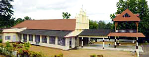 and the Valia palli(`Big Church`) perched on a picturesque hillock over a small cluster of houses. In the St.Mary`s Church Kuravilangad built in 355 AD there is an old bell which bears a hitherto undeciphered inscription. The mortal remains of the blessed Alphonsa and the Blessed Father Chavara are entombed at the St.Mary`s Church at Bharananganam and the St.Joseph`s Monastery Church at Mannanam respectively. Thousands gather at these holy shrines during festive occasions. Pala town and Kanjirappally, nourished by the Meenachil and Manimala rivers respectively are centers of rubber plantations. The Ettumanoor Shiva Temple 12 km north of town, has exceptionally beautiful wall paintings and sculptures inside the temple. In the heart of Kottayam town is the much venerated Thirunakkara Mahadeva temple.
Erumely
This is an important pilgrim centre for the Hindus and Muslims. Sree Dharmasastha Temple here is an ancient temple dedicated to Lord Ayyappa. Pilgrims going to Sabarimala alight here.
Aranmula
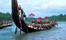 50km from Kottayam, Aranmula is the site of the splendid Onam festival boat races, usually in early September. These races unlike the more sporting Nehru Trophy race at Alappuzha in August are essentially religious, based on a temple festival. Caparisoned elephants with beaded umbrellas, processions of decorated floats, and highly ornate boats make this a lovely event to witness. Aranmula is also the centre of bell metal mirror crafts.
Vagamon
Vagamon, 64 km from Kottayam and 34 km from Pala, situated at an elevation of 1100 meters above sea level is a trekker`s paradise. It is an ideal tourist spot surrounded by the greenery of tea gardens, beautiful meadows and valleys. Other attractions: Thangal Para, Indo-Swiss project, Kurisumala Ashram.
Elaveezha Poonchira
Elaveezha Poonchira is yet another picnic spot accessible from Pala and located in the midst of beautiful hills.
 Vaikom
40km from Kottayam, famous for the Shiva Temple. The festival in November-December, last for 12 days and the `Panchavadyam` is an important musical performance.
Getting There
The nearest airport is Cochin, which is 80 kms away and Kottayam, 16 Km away, is the nearest railway head, which is well connected by trains from all major cities in India. It is easily accessible by road also.
Kumarakom, situated on the banks of the Vembanad Lake is one the world famous Backwater destinations of Kerala. Fishing, Boating and visits to the countryside make this destination a unique place to look forward to. Kumarakom also has a small bird sanctuary where different species of birds can be seen. A boat cruise along the Vembanad Lake is the best way to experience the serenity of the enchanting backwaters. Luxury hotels situated in this area to make your stay more relaxing and comfortable.Aruvikkuzhi Waterfalls
| |
Pathiramanal (sands of midnight), an enchanting island on the lake, can be accessed by boat from here. This 10 acre island on the backwaters is home to many rare varieties of migratory birds from different parts of the world. According to mythology a young Brahmin dived into the Vembanad Lake to perform his evening ablutions and the water madeway for the land to rise from below. The island can be accessed only by boat. A cruise along the Vembanad Lake is the best way to experience the sanctuary.
Kottayam
Kottayam is an ancient town famous for its churches, especially the 700 years-old churches, the Cheria palli (`small church`) with exceptionally lovely paintings over the altar
and the Valia palli(`Big Church`) perched on a picturesque hillock over a small cluster of houses. In the St.Mary`s Church Kuravilangad built in 355 AD there is an old bell which bears a hitherto undeciphered inscription. The mortal remains of the blessed Alphonsa and the Blessed Father Chavara are entombed at the St.Mary`s Church at Bharananganam and the St.Joseph`s Monastery Church at Mannanam respectively. Thousands gather at these holy shrines during festive occasions. Pala town and Kanjirappally, nourished by the Meenachil and Manimala rivers respectively are centers of rubber plantations. The Ettumanoor Shiva Temple 12 km north of town, has exceptionally beautiful wall paintings and sculptures inside the temple. In the heart of Kottayam town is the much venerated Thirunakkara Mahadeva temple. Erumely
This is an important pilgrim centre for the Hindus and Muslims. Sree Dharmasastha Temple here is an ancient temple dedicated to Lord Ayyappa. Pilgrims going to Sabarimala alight here.
Aranmula
50km from Kottayam, Aranmula is the site of the splendid Onam festival boat races, usually in early September. These races unlike the more sporting Nehru Trophy race at Alappuzha in August are essentially religious, based on a temple festival. Caparisoned elephants with beaded umbrellas, processions of decorated floats, and highly ornate boats make this a lovely event to witness. Aranmula is also the centre of bell metal mirror crafts.Vagamon
Vagamon, 64 km from Kottayam and 34 km from Pala, situated at an elevation of 1100 meters above sea level is a trekker`s paradise. It is an ideal tourist spot surrounded by the greenery of tea gardens, beautiful meadows and valleys. Other attractions: Thangal Para, Indo-Swiss project, Kurisumala Ashram.
Elaveezha Poonchira
Elaveezha Poonchira is yet another picnic spot accessible from Pala and located in the midst of beautiful hills.
Vaikom 40km from Kottayam, famous for the Shiva Temple. The festival in November-December, last for 12 days and the `Panchavadyam` is an important musical performance.
Getting There
The nearest airport is Cochin, which is 80 kms away and Kottayam, 16 Km away, is the nearest railway head, which is well connected by trains from all major cities in India. It is easily accessible by road also.
Weather
Weather

The district has a humid climate with an oppressive hot season from March to the end of May. This is followed by the southwest monsoon which continues till the end of September, October and November form the post-monsoon or retreating monsoon season. The northeast monsoon which follows, extends upto the end of February, although the rain generally ceases after December.
During the months of April and May, the mean daily maximum temperature is about 35° Celsius. Temperature is low in December and January and records as low as 20° Celsius. On certain days the night temperature may go down to 16° Celsius.
The annual average rainfall is 3,438 mm and more than 80 per cent of it occurs during the period of southwest monsoon. The rainfall during July is very heavy and the district receives 68 per cent of the annual rainfall during this season.
Friday, December 28, 2012
Aralam wild life sanctuary
Aralam wild life sanctuary
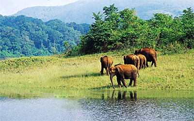 A tranquil mega sanctuary on the slopes of the Western Ghats covered with tropical and semi evergreen forests. Herds of deer, elephants, boar and bisons are quite common. Leopards, jungle cats, various type squirrels and rare species of birds have been found here. Around 160 species of birds have been found here. Certain species of birds, which are considered extinct, have also been found here. It is 35 kms from Thalassery Railway station.
A tranquil mega sanctuary on the slopes of the Western Ghats covered with tropical and semi evergreen forests. Herds of deer, elephants, boar and bisons are quite common. Leopards, jungle cats, various type squirrels and rare species of birds have been found here. Around 160 species of birds have been found here. Certain species of birds, which are considered extinct, have also been found here. It is 35 kms from Thalassery Railway station.
Kannur, Kerala
Kannur, Kerala
Kannur district derived its name from the location of its headquarters at Kannur town. The old name `Cannanore` is the anglicised form of the Malayalam word Kannur. According to one opinion, `Kannur` is a derivation from Kanathur, an ancient village, the name of which survives even today in one of the wards of Kannur municipality. Another version is that Kannur might have assumed its name from one of the deities of the Hindu pantheon, a compound of two words, `Kannan` (Lord Krishna) and `ur` (place) making it the place of Lord Krishna. In this context, it is worth mentioning that the deity of the Katalayi Srikrishna temple was originally installed in a shrine at Katalayi Kotta in the southeastern part of the present Kannur town.
Pazhassi Gardens & Dam
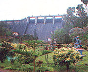
37 kms. east of Kannur near Mattannur the Pazhassi dam & reservoir offers scenic vistas. One can cruise down the river in D.T.P.C. boats often crossing small islands inhabited only riverine birds. The recently built Gardens & Amusement park is an added attraction. The Buddha’s mountain at Pazhassi, sculpture of Pazhassi King are interesting places to visit.
Dharmadam Island
Beside the Muzhappilangad beach 100 metres offshore lies the Dharmadam island surrounded by rivers and sea. A conjunction of beach & island it is a matter of walk during lowtide. Being a Buddhist stronghold it was earlier known as Dharmapattanam.
Arakkal Palace
 Its about 2 kms. from Kannur Town, steeped in History; it was the Beebi (Queen) of Arakkal, Kerala’s only Muslim Royal family that controlled parts of the coast and even Lakshadweep.
Fort St. Angelo
Don Francisco D. Almeida, the first Portuguese Viceroy of India, build the fort in 1505 AD. The fort had a chequered history. It changed hands to the Douche, then to the Ali Raja of Arakkal and finally to the British. The barracks, the magazine, cannons and the ruins of a chapel are all standing testimony history on the shores of the sea. Fort St. Angelo is a protected monument under the archaeological survey of India.
Madayi Mosque
This beautiful ancient mosque was originally built in 1124 AD by Malic Iben Dinar, a Muslim preacher. A block of white marble in the mosque is believed to have been brought from Mecca by its founder, who came to India to spread the word of the prophet. Near by dilapidated fort believed to have been built by Tipu Sultan: the ruler of Mysore.
Kannur district derived its name from the location of its headquarters at Kannur town. The old name `Cannanore` is the anglicised form of the Malayalam word Kannur. According to one opinion, `Kannur` is a derivation from Kanathur, an ancient village, the name of which survives even today in one of the wards of Kannur municipality. Another version is that Kannur might have assumed its name from one of the deities of the Hindu pantheon, a compound of two words, `Kannan` (Lord Krishna) and `ur` (place) making it the place of Lord Krishna. In this context, it is worth mentioning that the deity of the Katalayi Srikrishna temple was originally installed in a shrine at Katalayi Kotta in the southeastern part of the present Kannur town.
Pazhassi Gardens & Dam
37 kms. east of Kannur near Mattannur the Pazhassi dam & reservoir offers scenic vistas. One can cruise down the river in D.T.P.C. boats often crossing small islands inhabited only riverine birds. The recently built Gardens & Amusement park is an added attraction. The Buddha’s mountain at Pazhassi, sculpture of Pazhassi King are interesting places to visit.
Dharmadam Island
Beside the Muzhappilangad beach 100 metres offshore lies the Dharmadam island surrounded by rivers and sea. A conjunction of beach & island it is a matter of walk during lowtide. Being a Buddhist stronghold it was earlier known as Dharmapattanam.
Arakkal Palace
Its about 2 kms. from Kannur Town, steeped in History; it was the Beebi (Queen) of Arakkal, Kerala’s only Muslim Royal family that controlled parts of the coast and even Lakshadweep. Fort St. Angelo
Don Francisco D. Almeida, the first Portuguese Viceroy of India, build the fort in 1505 AD. The fort had a chequered history. It changed hands to the Douche, then to the Ali Raja of Arakkal and finally to the British. The barracks, the magazine, cannons and the ruins of a chapel are all standing testimony history on the shores of the sea. Fort St. Angelo is a protected monument under the archaeological survey of India.
Madayi Mosque
This beautiful ancient mosque was originally built in 1124 AD by Malic Iben Dinar, a Muslim preacher. A block of white marble in the mosque is believed to have been brought from Mecca by its founder, who came to India to spread the word of the prophet. Near by dilapidated fort believed to have been built by Tipu Sultan: the ruler of Mysore.
Hubli
Hubli

Hubli, also known as Hubbali, is part of the twin cities of Hubli - Dharwad and a well-known industrial town. A major city of Dharwad district in Karnataka, Hubli is renowned for its handloom textile units and has several cotton ginning and processing mills. Hubli is situated 80 km from Belgaum, 160 km from Goa, 420 km north of Bangalore, and 550 km south of Mumbai. It is the second-largest city in Karnataka, after Bangalore. The climate of the city is extremely good throughout the year, however the best time to visit Hubli is between the months of October and March. It is also an important city for the Indian Railways, being the headquarters for South Western Railway Zone and the Hubbali Division.
The historic town of Hubli was formerly known as Raya Hubli and also as Elaya Puravada Halli. During the reign of the Vijaynagara Empire, Hubli was transformed into an important cotton and iron trade center. Bhavanishankar Temple is a worth watching site of Hubli. This Chalukyan Temple has an image of Sri Narayana, with ten incarnations of God around it. There is the famous Moorusavira Matha, and the Matha authorities claim that it was begun by a Sharana of Basaveshwara`s period.
Hubli is an important industrial center, boasting more than 1000 allied small and medium industries already established. There are machine tools industries, steel furniture stores, electrical, food products, rubber and leather industries and tanning industries. With the establishment of K.E.C, Universal Group of Industries, Bhoruka textile Mill, Microfinish Group, BDK Group of Industries and Murudeshwar Ceramics, this city has gathered momentum in industrial development. Popular group of hotels, Kamat Group, started off in this very city. IT Park Hubli is situated in the heart of the city and is promoted by the Government of Karnataka.
Kundgol is the haven for renowned Hindustani classical music singers, situated about 20 km southeast of Hubballi. Panchakshri Gavai, Pandit Sawai Gandharva, Pandit Putturaj Gawai, Pandit Mallikarjun Mansoor, Pandit Kumar Gandharva, Pandit Basavaraj Rajguru, Gangubai Hangal, Pandit Arjunsa Nakod and Pandit Bhimsen Joshi are some of the outstanding personalities of music world from this part of the region who have enriched the Hindustani music with their contributions. Hindustani music is patronized in the regions of Hubli-Dharwad, Hyderabad Karnataka, Belgaum region. Hubli has numerous colleges and schools in all streams providing quality education. Karnataka Institute of Medical Sciences (KIMS) and KLE Society Belgaum`s BVB College of Engineering and Technology are the best-known institutions of Hubli.
Dollu Kunitha is a popular drum dance and is at times accompanied with songs relating to religious praise or wars. The large drums are decorated with coloured cloth, and are slung around the necks of men. Veeragase is popular folk dance. It is a symbolic presentation of the heroism and valour of God Veerabahadhra. Its exponents are called Lingadevaru and they dance with religious fervour at festival time especially during the months of Shravana and Kartika. Nandikolu kunitha and Jodu halige are two more local art forms of Hubli. While Lambani nruthya, women dressed colorfully move circularly, clapping and singing. Veerabhadra kunitha is the dance form that depicts the story of Veerabhadra, the legendary minor god created by Lord Siva to teach a lesson to his father-in-law Daksha. The folk art forms of Hubli are some of the oldest and most exquisite ones in India.
 Asar was built in about 1646 AD by Mohammed Ali Shah to serve as a hall of justice. This edifice was also used to safely store two hairs from the Prophet`s beard. Siddharoodha Math is an eminent religious institution in Hubli and a centre of Advaita philosophy as preached by Swami Siddharoodha, is located just 2 km from Hubli.
Unkal Lake is a pictorial water spot with a superb sunset view; this perfect picnic spot has green garden, entertaining facilities for the children, boating facilities and so on. The lake is created 3 km away from Hubli. Glass House is a palace of glass in Hubli, inaugurated by the former Indian Prime Minister, Smt. Indira Gandhi. The important places around Hubli include Navilteerth that is situated 53 km from Hubli and a picturesque spot on the way to Ramadurga is ideal for a picnic. Sathodi and Mathodi Falls are ideal destination for trekkers and nature lovers, this falls on Hubli - Karwar Highway is 85 km away from Hubli. Sykes Point is a picnic spot, located 84 km from Hubli, and is a nice place to watch nature`s beauty and sunset. Ulavia is sited near Dandeli, 98 km from Hubli. This is a holy place where Shri Chennabasaveshwar Temple is situated.
Dharwad Utsav is an event comprises of a daylong Hindustani music concert held in the twin cities of Hubli and Dharwad, generally in the month of November. Music, dance, theater, painting, Janapada and other events mark the celebrations. The tourists can enjoy a comfortable stay while on a tour to Hubli, at the hotels in Hubli, offering a remarkable blend of tradition and modernity. One can reach Hubli by air, through its own airport, located 18 km away. One can also reach Hubli by its major rail junction on the Mumbai - Bangalore route and the city is also well-connected to places like Vasco da Gama and Margao in Goa. Hubli is connected by a network of roads to all major cities of Karnataka and also to neighboring Maharashtra and other cities in South India.
Hubli, also known as Hubbali, is part of the twin cities of Hubli - Dharwad and a well-known industrial town. A major city of Dharwad district in Karnataka, Hubli is renowned for its handloom textile units and has several cotton ginning and processing mills. Hubli is situated 80 km from Belgaum, 160 km from Goa, 420 km north of Bangalore, and 550 km south of Mumbai. It is the second-largest city in Karnataka, after Bangalore. The climate of the city is extremely good throughout the year, however the best time to visit Hubli is between the months of October and March. It is also an important city for the Indian Railways, being the headquarters for South Western Railway Zone and the Hubbali Division.
The historic town of Hubli was formerly known as Raya Hubli and also as Elaya Puravada Halli. During the reign of the Vijaynagara Empire, Hubli was transformed into an important cotton and iron trade center. Bhavanishankar Temple is a worth watching site of Hubli. This Chalukyan Temple has an image of Sri Narayana, with ten incarnations of God around it. There is the famous Moorusavira Matha, and the Matha authorities claim that it was begun by a Sharana of Basaveshwara`s period.
Hubli is an important industrial center, boasting more than 1000 allied small and medium industries already established. There are machine tools industries, steel furniture stores, electrical, food products, rubber and leather industries and tanning industries. With the establishment of K.E.C, Universal Group of Industries, Bhoruka textile Mill, Microfinish Group, BDK Group of Industries and Murudeshwar Ceramics, this city has gathered momentum in industrial development. Popular group of hotels, Kamat Group, started off in this very city. IT Park Hubli is situated in the heart of the city and is promoted by the Government of Karnataka.
Kundgol is the haven for renowned Hindustani classical music singers, situated about 20 km southeast of Hubballi. Panchakshri Gavai, Pandit Sawai Gandharva, Pandit Putturaj Gawai, Pandit Mallikarjun Mansoor, Pandit Kumar Gandharva, Pandit Basavaraj Rajguru, Gangubai Hangal, Pandit Arjunsa Nakod and Pandit Bhimsen Joshi are some of the outstanding personalities of music world from this part of the region who have enriched the Hindustani music with their contributions. Hindustani music is patronized in the regions of Hubli-Dharwad, Hyderabad Karnataka, Belgaum region. Hubli has numerous colleges and schools in all streams providing quality education. Karnataka Institute of Medical Sciences (KIMS) and KLE Society Belgaum`s BVB College of Engineering and Technology are the best-known institutions of Hubli.
Dollu Kunitha is a popular drum dance and is at times accompanied with songs relating to religious praise or wars. The large drums are decorated with coloured cloth, and are slung around the necks of men. Veeragase is popular folk dance. It is a symbolic presentation of the heroism and valour of God Veerabahadhra. Its exponents are called Lingadevaru and they dance with religious fervour at festival time especially during the months of Shravana and Kartika. Nandikolu kunitha and Jodu halige are two more local art forms of Hubli. While Lambani nruthya, women dressed colorfully move circularly, clapping and singing. Veerabhadra kunitha is the dance form that depicts the story of Veerabhadra, the legendary minor god created by Lord Siva to teach a lesson to his father-in-law Daksha. The folk art forms of Hubli are some of the oldest and most exquisite ones in India.
Asar was built in about 1646 AD by Mohammed Ali Shah to serve as a hall of justice. This edifice was also used to safely store two hairs from the Prophet`s beard. Siddharoodha Math is an eminent religious institution in Hubli and a centre of Advaita philosophy as preached by Swami Siddharoodha, is located just 2 km from Hubli.Unkal Lake is a pictorial water spot with a superb sunset view; this perfect picnic spot has green garden, entertaining facilities for the children, boating facilities and so on. The lake is created 3 km away from Hubli. Glass House is a palace of glass in Hubli, inaugurated by the former Indian Prime Minister, Smt. Indira Gandhi. The important places around Hubli include Navilteerth that is situated 53 km from Hubli and a picturesque spot on the way to Ramadurga is ideal for a picnic. Sathodi and Mathodi Falls are ideal destination for trekkers and nature lovers, this falls on Hubli - Karwar Highway is 85 km away from Hubli. Sykes Point is a picnic spot, located 84 km from Hubli, and is a nice place to watch nature`s beauty and sunset. Ulavia is sited near Dandeli, 98 km from Hubli. This is a holy place where Shri Chennabasaveshwar Temple is situated.
Dharwad Utsav is an event comprises of a daylong Hindustani music concert held in the twin cities of Hubli and Dharwad, generally in the month of November. Music, dance, theater, painting, Janapada and other events mark the celebrations. The tourists can enjoy a comfortable stay while on a tour to Hubli, at the hotels in Hubli, offering a remarkable blend of tradition and modernity. One can reach Hubli by air, through its own airport, located 18 km away. One can also reach Hubli by its major rail junction on the Mumbai - Bangalore route and the city is also well-connected to places like Vasco da Gama and Margao in Goa. Hubli is connected by a network of roads to all major cities of Karnataka and also to neighboring Maharashtra and other cities in South India.
Iriveri, Kannur district of Kerala
Iriveri, Kannur district of Kerala

Iriveri is a beautiful place in Kannur district in the south Indian state of Kerela. It is located on the eastern side of Kannur. A primary attraction of Iriveri is the Iriveri Kavu. The temples situated in Iriveri are Ambiliyad Sri Krishna Temple and Manikkiyil Bhagavati Temple.
According to the census report published in 2001, Iriveri had a population of 15,672. Males constitute 48% of the population and females constitute 52% of the population. In Iriveri, 12% of the population is less than six years of age. The census report also brought out the literacy rate of Iriveri, which is 84%. This is a progressive trend as the national average literacy rate is 59.5%. To be specific, the male literacy rate is 85% and the female literacy rate is 82%.
| |
Thursday, December 27, 2012
Dharmadom, Kannur, Kerala
Dharmadom, Kannur, Kerala
Dharmadom earlier known as Dharmapattanam is a small town in Kannur district of Kerala. The town is situated 17 km from Kannur and around 15 km. from Mahe. The neighbouring towns are Edakkad, Thalassery, Mokeri, Kottayam and Muzapilangadu. The town is situated on the National Highway connecting Thalassery and Edakkad. This town is well connected to other places in the state. The bus service is regular and connects Dharmadom with Thalassery and Kannur. The nearest railway station is the Dharmadom Railway Station on the Thalassery- Kannur rail route and the nearest airport is the Calicut Airport.
According to the 2001 census report, Dharmadom had a population of 29,169 inhabitants. Males constitute 47% of the population and females constitute 53% of the population. In Dharmadom, 9% of the population is less than six years of age. The town has an average literacy rate of 87%, which is higher than the national average of 59.5%. The male literacy rate is 88% and the female literacy rate is 86%.
The Thalassery River, Thalassery Fort, St Johns Church, Thodikalam Shiva Temple and Overbury`s Folly are places of tourist interest in the district. The Dharmadom Island is a beautiful beach island surrounded with coconut palms and green bushes and situated at a distance of 100 metres from Dharmadom is a major tourist destination.
Dharmadom earlier known as Dharmapattanam is a small town in Kannur district of Kerala. The town is situated 17 km from Kannur and around 15 km. from Mahe. The neighbouring towns are Edakkad, Thalassery, Mokeri, Kottayam and Muzapilangadu. The town is situated on the National Highway connecting Thalassery and Edakkad. This town is well connected to other places in the state. The bus service is regular and connects Dharmadom with Thalassery and Kannur. The nearest railway station is the Dharmadom Railway Station on the Thalassery- Kannur rail route and the nearest airport is the Calicut Airport.
According to the 2001 census report, Dharmadom had a population of 29,169 inhabitants. Males
constitute 47% of the population and females constitute 53% of the population. In Dharmadom, 9% of the population is less than six years of age. The town has an average literacy rate of 87%, which is higher than the national average of 59.5%. The male literacy rate is 88% and the female literacy rate is 86%.The Thalassery River, Thalassery Fort, St Johns Church, Thodikalam Shiva Temple and Overbury`s Folly are places of tourist interest in the district. The Dharmadom Island is a beautiful beach island surrounded with coconut palms and green bushes and situated at a distance of 100 metres from Dharmadom is a major tourist destination.
Chevvoor, Thrissur, Kerala
Chevvoor, Thrissur, Kerala
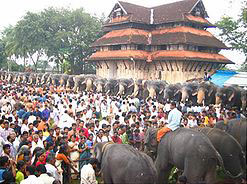
Chevvoor is a census town in Thrissur district in the state of Kerala. According to the 2001 census report, the population of Chevvoor was 17,373 .48% of the population is male and 52% of the population is female and 11% of the population is under six years of age .The literacy rate of Chevvoor is 84% which is higher than the average literacy standard set at 59.5%.
Chevvoor is a census town in Thrissur district in the state of Kerala. According to the 2001 census report, the population of Chevvoor was 17,373 .48% of the population is male and 52% of the population is female and 11% of the population is under six years of age .The literacy rate of Chevvoor is 84% which is higher than the average literacy standard set at 59.5%.
Kokkothamangalam, Alappuzha, Kerala
Kokkothamangalam, Alappuzha, Kerala
Vast continent of India is thronged with cities and towns. In the state of Kerala, one comes across several towns as well. Kokkothamangalam is a residential area, which is built in Alappuzha district in the Indian state of Kerala. In Alappuzha district. Kokkothamangalam lies on the western coast of Vembanad Lake at Cherthala . Some even identifies Kokkothamangalam as Kokkomangalam.
Identification of a town or city in India becomes half hearted unless and until one gets enough information about the demography of that particular place. Thus to achieve this target, a handful of demographers have been appointed so as to conduct surveys and research works in Kokkothamangalam. On the basis of their findings, they have successfully prepared comprehensive thus throwing light on certain demographical aspects like population status, literacy rate etc. The prominent one is the Census report that has been brought out in the year 2001. As per this report, the total population of Kokkothamangalam showed a total population count of 16,852. Interestingly, the number of females is more than that of females. This is evident from their literacy rates. In other words , in Kokkothamangalam female populace constitutes 51 % . Male population is less thus constituting 49 %. In Kokkothamangalam place , 10 % of the total population is below six years of age.
 How much a town in India has achieved development is quite evident from its literacy condition. In other words , literacy rate is a vital indicator for gauging the growth and prosperity of a town. Since Kokkothamangalam`s average literacy rate is 85 %, which is much higher than that of India , it rightly affirms its growth and development. 59.5 % is the average literacy rate of India. Not only that the status of male and female literacy rates too are quite high. Male literacy rate is 88 %, and female literacy rate is also no les insignificant thereby constituting 82 %.
The scenic beauty of this Kokkothamangalam enhances the inflow of tourists every year. One of the 2 two important churches in the Arch Diocese of Ernakulam has been built here Devotees of varied religion , caste and creed, go this church in Kokkothamangalam.
To facilitate easy accessibility, Kokkothamangalam is connected with other places of India by rails and airports. Cochin International Airport and `Cherthala Railway Station on the Ernakulam- Alappuzha line` lie in close vicinity.
Vast continent of India is thronged with cities and towns. In the state of Kerala, one comes across several towns as well. Kokkothamangalam is a residential area, which is built in Alappuzha district in the Indian state of Kerala. In Alappuzha district. Kokkothamangalam lies on the western coast of Vembanad Lake at Cherthala . Some even identifies Kokkothamangalam as Kokkomangalam.
Identification of a town or city in India becomes half hearted unless and until one gets enough information about the demography of that particular place. Thus to achieve this target, a handful of demographers have been appointed so as to conduct surveys and research works in Kokkothamangalam. On the basis of their findings, they have successfully prepared comprehensive thus throwing light on certain demographical aspects like population status, literacy rate etc. The prominent one is the Census report that has been brought out in the year 2001. As per this report, the total population of Kokkothamangalam showed a total population count of 16,852. Interestingly, the number of females is more than that of females. This is evident from their literacy rates. In other words , in Kokkothamangalam female populace constitutes 51 % . Male population is less thus constituting 49 %. In Kokkothamangalam place , 10 % of the total population is below six years of age.
How much a town in India has achieved development is quite evident from its literacy condition. In other words , literacy rate is a vital indicator for gauging the growth and prosperity of a town. Since Kokkothamangalam`s average literacy rate is 85 %, which is much higher than that of India , it rightly affirms its growth and development. 59.5 % is the average literacy rate of India. Not only that the status of male and female literacy rates too are quite high. Male literacy rate is 88 %, and female literacy rate is also no les insignificant thereby constituting 82 %. The scenic beauty of this Kokkothamangalam enhances the inflow of tourists every year. One of the 2 two important churches in the Arch Diocese of Ernakulam has been built here Devotees of varied religion , caste and creed, go this church in Kokkothamangalam.
To facilitate easy accessibility, Kokkothamangalam is connected with other places of India by rails and airports. Cochin International Airport and `Cherthala Railway Station on the Ernakulam- Alappuzha line` lie in close vicinity.
Kannapuram, Kannur, Kerala
Kannapuram, Kannur, Kerala

While traveling in India one comes across several towns and cities that have originated here over the years. The state of Kerala too is not an exception in this regard. Amongst several towns , one distinguishes Kannapuram to be quite significant. In fact Kannapuram is an example of census town. It is situated in the district of Kannur of Kerala state of India.
With the sole purpose of identifying the demographical scenario of Kannapuram which is inevitable for the knowledge of any town , eminent demographers have conducted numerous surveys and research works and thus threw some light on its demography . In this regard it would be wrong if one does not put forth the name of Census report of the year 2001 as one of the relevant documents. Important information viz. population status, literacy rate etc can be deciphered if one properly throws a glance on this report. According to this report, the total population of Kannapuram has been enumerated to be 18,568. Out of it, information about male and female populace separately can be drawn forth. Interestingly it has been highlighted that female populace in Kannapuram is more than that of males. Thus male populace constitutes of 46 percent, while the population of females is 54 percent. . In Kannapuram town, 10 percent of the total population is below six years of age.
Not only that glimpsing the report one can decipher that the people of Kannapuram are very much oriented to education. 84 percent is the average literacy rate of Kannapuram, which is much higher than that of the whole nation. 59.5 percent is the average literacy rate of India. Not only that, individually also male and female literacy rates is quite high. Thus male literacy rate constitutes of 86 percent and the rate of female literacy is also 81 percent.
Mulavukad, Eranakulam, Kerala
Mulavukad, Eranakulam, Kerala
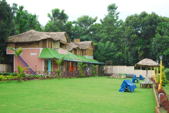
Mulavukad is a picturesque `census town` located in the Eranakulam district of the southern state of India, Kerala. It is actually a beautiful island located in the Kochi backwaters and in the southern end of the town lies the Bolghatty Island. It is spread over an area of 20 square kilometers and the serenity of the place makes it an ideal retreat for all tourists. The International Airport at Cochin is the nearest airport. On the eastern side of Mulavukad flows the famous Periyar River.
As per the Indian Census report of 2001, Mulavukad in Kerala had a population of 22,845. Males account for 49% of the population and females comprises of the remaining 51%. In Mulavukad, 11% of the population is less than six years of age. The average literacy rate of Mulavukad is 86%, which is higher than the national average literacy rate, which is 59.5%. The male literacy rate in Mulavukad in Kerala is 87% and the female literacy rate is 84%.
Some of the places of interest in Mulavukad are St John`s Church, a Mission Station of the Immanuel Church and the Sree Kereleshwaram Temple.
Madhur, Kasargod, Kerala
| Madhur, Kasargod, Kerala Madhur is a Hindu Pilgrim centre, about 8 km from Kasargod , Kerala . The famous Srimad Anantheswara Vinayaka temple of Kerala is situated here at the distance of 8 km north east of Kasargod.
 Namaskara Mandapam, which is situated in the temple, has been decorated with beautiful figures of puranic heroes in wood. Woodcarvings usually depict the various episodes of the Ramayana, beginning with the Seethga Swayamvaram. The Mantapam in the interior of the temple building as well as the outside surface of the second and third storey of the main building are also profuse with attractive and exquisite woodcarvings. Namaskara Mandapam, which is situated in the temple, has been decorated with beautiful figures of puranic heroes in wood. Woodcarvings usually depict the various episodes of the Ramayana, beginning with the Seethga Swayamvaram. The Mantapam in the interior of the temple building as well as the outside surface of the second and third storey of the main building are also profuse with attractive and exquisite woodcarvings. It is said that at the time when Tipu Sultan of Mysore attacked the temple during his invasion. He felt thirsty and drunk the water from the temple well. So this is believed that after drinking the water he has changed his mind and left the temple without damaging it. There is also a mask on the temple, which is made by Tipu with his sword. |
Bekal, Kasargod, KeralaK
Bekal, Kasargod, Kerala
Bekal is an important place of tourist interest in the district situated on the seashore of Pallikara village. It lies 12 km south of Kasargod town. According to Bekal Rama Nayak who was a local Kannada writer, the word, Bekal is derived from the word Baliakulam that means Big Palace. The term Baliakulam over a period of time got corrupted as Bekulam and later as Bekal.
In earlier days every royal palace were protected by a fort. The Bekal have existed even from early days of the Chirakkal Rajas.
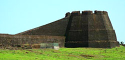 The Bekal fort is of great historical and archaeological interest. Many people from different parts of the world come to view this place. It is actually the largest and best preserved of its kind in the district and the land on which it is situated, runs into the sea with fine bay towards the south. According to the South Canara Mannual, Bekaln fort was under the province of Haider Ali in 1763. It rendered the Huzur of Canara during Tipu`s time. After the overthrow of Tipu Sultan in 1799, Bekal was incorporated into the territories of the English East India Company. The former Kasaragod taluk of South Canara district was known as Bekal for more than half a century. Thus the history of the place can be described.
Bekal is an important place of tourist interest in the district situated on the seashore of Pallikara village. It lies 12 km south of Kasargod town. According to Bekal Rama Nayak who was a local Kannada writer, the word, Bekal is derived from the word Baliakulam that means Big Palace. The term Baliakulam over a period of time got corrupted as Bekulam and later as Bekal.
In earlier days every royal palace were protected by a fort. The Bekal have existed even from early days of the Chirakkal Rajas.
The Bekal fort is of great historical and archaeological interest. Many people from different parts of the world come to view this place. It is actually the largest and best preserved of its kind in the district and the land on which it is situated, runs into the sea with fine bay towards the south. According to the South Canara Mannual, Bekaln fort was under the province of Haider Ali in 1763. It rendered the Huzur of Canara during Tipu`s time. After the overthrow of Tipu Sultan in 1799, Bekal was incorporated into the territories of the English East India Company. The former Kasaragod taluk of South Canara district was known as Bekal for more than half a century. Thus the history of the place can be described.
Kudlu, Kasaragod, Kerala
Kudlu, Kasaragod, Kerala
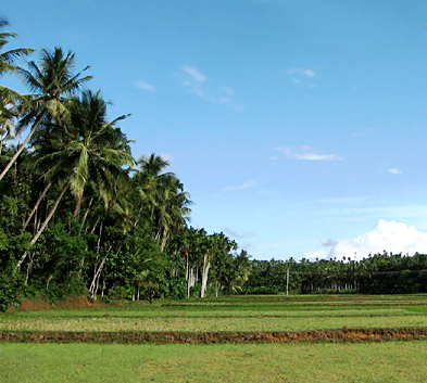 In various states of India, a multitude of towns and cities have developed by leaps and bounds. The state of Kerala too is not an exception. Kudlu is one such significant place . It is the name of a residential place and it is situated in the district of Kasaragod district of Kerala state.
If one wishes to carry on discussion on any particular town, the first thing that one needs to do is to gather information about the demography of that place. Without identifying its demography the knowledge about the town would not be complete. Regarding Kudlu town also it can be said that several demographers have tried their level best to gather more and more data about Kudlu town`s demography. A due mentioning is the Census report of India that has been issued forth in the year 2001 thus inferring demographical scenario of Kudlu.
In various states of India, a multitude of towns and cities have developed by leaps and bounds. The state of Kerala too is not an exception. Kudlu is one such significant place . It is the name of a residential place and it is situated in the district of Kasaragod district of Kerala state.If one wishes to carry on discussion on any particular town, the first thing that one needs to do is to gather information about the demography of that place. Without identifying its demography the knowledge about the town would not be complete. Regarding Kudlu town also it can be said that several demographers have tried their level best to gather more and more data about Kudlu town`s demography. A due mentioning is the Census report of India that has been issued forth in the year 2001 thus inferring demographical scenario of Kudlu.
| |
Wednesday, December 26, 2012
Kasargod town, Kerala
Kasargod town, Kerala

This municipal town is situated on the bank of river Chandragiri. This place is the confluence of several languages and culture where eight languages are spoken. The splendor of kasaragod saree comparable to that of kanjeepuram is a cynosure of the market.
kasargod is the emporium of cash crops like areca nut and coconut. The worshiping places of historical importance like malik-deenar juma masjid, malika arjuna temple and dolors church are present here. pulikkunnu, one of the seats of the assembly of gods where 39 theyyams are presented for the annual festivals. Some of the other features of this town can be explained, as this is an important business center and placed at 31 metre above sea level
Minerals and mining
Minerals and mining:
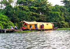 The glass and foundry sand are the two most important minerals that occur in large quantities in the district. Lime shell is exploited commercially. High quality sand deposits occur between Alappuzha and Cherthala, which form a stretch of 35 Km in length along the western side of Vembanad Lake. At Pallipuram large quantities of sand are being mined for manufacturing sand lime bricks. Vast deposits of lime shell occur in Vembanad Lake covering an area of 15 Sq.Km. up to depth of 8 metres between Pathiramanal and Vaikom. China clay and ordinary clay, which occur in various places, are used as building materials. The raw material required for granite carving is obtained from Chengannur.
The glass and foundry sand are the two most important minerals that occur in large quantities in the district. Lime shell is exploited commercially. High quality sand deposits occur between Alappuzha and Cherthala, which form a stretch of 35 Km in length along the western side of Vembanad Lake. At Pallipuram large quantities of sand are being mined for manufacturing sand lime bricks. Vast deposits of lime shell occur in Vembanad Lake covering an area of 15 Sq.Km. up to depth of 8 metres between Pathiramanal and Vaikom. China clay and ordinary clay, which occur in various places, are used as building materials. The raw material required for granite carving is obtained from Chengannur.
Soil and crops:
Soil and crops:

In the taluks of western parts of Cherthala, Ambalapurzha, Karthikappally the main soil is sandy and main crop is coconut। The taluks of Eastern regions of Cherthala & Ambalapuzha, and Western portions of Kuttanad possess Peaty and Kari types of soil. In the taluks of rest of Kuttanad, north eastern portions of Karthikappally, western portions of Chengannur, north western sector of Mavelikkara & the delta region formed by Pamba, Manimala and Achenkovil rivers near its confluence with the Vembanad lake, the main soil is Alluvial and the crops found there are paddy and sugar cane. The soil Laterite is found in the taluks of major portion of Chengannur and Mavelikkara and the main crops that are available there are mainly coconut arecanut, fruit trees, etc. Whereas in the taluks of Cherthala, Ambalapuzha and Karthikappally the main soil is sandy and the main crop is coconut.
Geology:
The geological formations of the district are classified as follows:
A belt of crystalline rocks of the archean group A belt of residual laterite A narrow belt of warkalli bed of tertiary group A western most coastal belt of recent deposits
In the taluks of western parts of Cherthala, Ambalapurzha, Karthikappally the main soil is sandy and main crop is coconut। The taluks of Eastern regions of Cherthala & Ambalapuzha, and Western portions of Kuttanad possess Peaty and Kari types of soil. In the taluks of rest of Kuttanad, north eastern portions of Karthikappally, western portions of Chengannur, north western sector of Mavelikkara & the delta region formed by Pamba, Manimala and Achenkovil rivers near its confluence with the Vembanad lake, the main soil is Alluvial and the crops found there are paddy and sugar cane. The soil Laterite is found in the taluks of major portion of Chengannur and Mavelikkara and the main crops that are available there are mainly coconut arecanut, fruit trees, etc. Whereas in the taluks of Cherthala, Ambalapuzha and Karthikappally the main soil is sandy and the main crop is coconut.
Geology:
The geological formations of the district are classified as follows:
Alappuzha town , Kerala
Alappuzha town , Kerala
Also termed as Alleppy, Alappuzha laced with the azure brilliance of the Arabian sea and with the web of the flowing rivers is one of the beautiful town, nestled at the Alappuzha District of Kerala. Braided with the scenic beauty of the backwaters, canals, lagoons and beaches Alappuzha is as if a dream turned into reality. The magnificent presence of the dock, the unbroken and sun kissed sea coast has offered a marked dimension to this place whilst making it the "Venice of the East" in the worls tourism map.
Demography:
Alappuzha is the smallest district of Kerala. Area wise its 1,414 Sq.Km, which constitutes 3.64% of the total state area. The population size is 2,105,349, which is 6.61 % of the total state population.Population density is 1492 persons per Sq.Km, against 1415 in 1991- retain the first position in the state.Sex ratio, which is no. of females per 1000 males is 1079 , earning 4th position, previously it was 5th position in 1991 with 1051.Literacy Rate is 93.66 %, which is able to earn a 3rd position in the state. In other State Average cases are 90.92%.Female Literacy rate is 91.14, which again earns 3rd position in the state. While State Average is 87.86%.
Geography:
North Latitudes - 9o05` and 9o54` East Longitudes - 76o17` 30" and 76o40`.
Boundaries:
In North there is Kochi and Kanayannur Taluks of Ernakulam Districts.In East side there is Vaikom, Kottayam and Changanassery Taluks of Kottayam district andThiruvalla, Kozhencherry and Adoor taluks of Pathanamthitta District.In South there is Kunnathur and Karunagappally of Kollam District.In West there is Lakshadweep or Arabian Sea.
Topography:
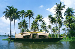 The district is a sandy piece of land intercepted by lagoons, rivers and canals. In the eastern portion of the district there are some scattered hillocks lying between Bharanikkavu and Chngannur blocks. Apart from those there are no mountains or hills in the district. Cherthala, Ambalappuzha, Kuttanad and Karthikappally fully lie in low land region. There is no forest area in this district.
Climate:
The climate is moist and hot in the coast and slightly cool and dry in the interior of the district. The average monthly temperature is 250C. The district also gets the benefit of two outstanding monsoons as in the case of other parts of the state. Hot season starts from March and lasts till May
South-west monsoon (Edavappathi) lasts from June to September, North-east monsoon (Thulavarsham) starts from October to November; and Dry weather starts from December and ends on February.
In 1989 it was recorded that the district has 8 reporting rain gauge stations at Arookutty, Cherthala, Alappuzha, Ambalapuzha, Harippad, Kayamkulam, mavelikkara and Chengannur. The average rainfall in the district is 2763 mm.
Also termed as Alleppy, Alappuzha laced with the azure brilliance of the Arabian sea and with the web of the flowing rivers is one of the beautiful town, nestled at the Alappuzha District of Kerala. Braided with the scenic beauty of the backwaters, canals, lagoons and beaches Alappuzha is as if a dream turned into reality. The magnificent presence of the dock, the unbroken and sun kissed sea coast has offered a marked dimension to this place whilst making it the "Venice of the East" in the worls tourism map.
Demography:
Alappuzha is the smallest district of Kerala. Area wise its 1,414 Sq.Km, which constitutes 3.64% of the total state area. The population size is 2,105,349, which is 6.61 % of the total state population.Population density is 1492 persons per Sq.Km, against 1415 in 1991- retain the first position in the state.Sex ratio, which is no. of females per 1000 males is 1079 , earning 4th position, previously it was 5th position in 1991 with 1051.Literacy Rate is 93.66 %, which is able to earn a 3rd position in the state. In other State Average cases are 90.92%.Female Literacy rate is 91.14, which again earns 3rd position in the state. While State Average is 87.86%.
Geography:
Boundaries:
In North there is Kochi and Kanayannur Taluks of Ernakulam Districts.In East side there is Vaikom, Kottayam and Changanassery Taluks of Kottayam district andThiruvalla, Kozhencherry and Adoor taluks of Pathanamthitta District.In South there is Kunnathur and Karunagappally of Kollam District.In West there is Lakshadweep or Arabian Sea.
Topography:
The district is a sandy piece of land intercepted by lagoons, rivers and canals. In the eastern portion of the district there are some scattered hillocks lying between Bharanikkavu and Chngannur blocks. Apart from those there are no mountains or hills in the district. Cherthala, Ambalappuzha, Kuttanad and Karthikappally fully lie in low land region. There is no forest area in this district.Climate:
The climate is moist and hot in the coast and slightly cool and dry in the interior of the district. The average monthly temperature is 250C. The district also gets the benefit of two outstanding monsoons as in the case of other parts of the state. Hot season starts from March and lasts till May
South-west monsoon (Edavappathi) lasts from June to September, North-east monsoon (Thulavarsham) starts from October to November; and Dry weather starts from December and ends on February.
In 1989 it was recorded that the district has 8 reporting rain gauge stations at Arookutty, Cherthala, Alappuzha, Ambalapuzha, Harippad, Kayamkulam, mavelikkara and Chengannur. The average rainfall in the district is 2763 mm.
Kozhikode, Kerala
Kozhikode, Kerala
Kozhikode, also most legendary as Calicut, is a city situated in the southern Indian state of Kerala. Kozhikode serves as the third largest city in Kerala and also the headquarters of Kozhikode district. Calicut once served as the capital of an erstwhile independent kingdom and later of the one-time Malabar District. Indeed, history of Kozhikode has much to offer to one`s platter of curiosity to learn more about this ancient city of seafaring wonders. Kozhikode is the third largest urban agglomeration in Kerala.
Kozhikode is precisely located by the long coastline of the legendary Malabar coastal region and the erstwhile referred Calicut does possess immense cultural traditions and lingo of its own; the city still is a trading nerve centre for spices and tiles and sometimes also acknowledged as the `land of spices`. The current name `Kozhikode` has been derived from the words `Koyil` (palace) and `Kodu` (fortified). The city found its idyllic place in world history when Portuguese navigator Vasco De Gama had discovered this very coastal region as a sea route to India in 1498. Kozhikode, as a result is presently identified by various names - the Arabs had referred to it as `Kalikat` and Chinese `Kalifo`. During the invasion and subjugation of Malabar, Tipu Sulthan had endeavoured to change the name of the city into `Ferozabad`. The city is immensely popular for its `Kozhikodan Halwas`, a sweet dish prepared by flour and jaggery and the traditional Muslim food, especially seafood cuisines made from prawns, crabs, lobster and shell creature known as kallummekkaya or kadukka. The present times, primeval monuments, tranquil beaches, historic sites, wildlife sanctuaries, rivers, hills, a distinctive culture and a warm friendly ambience, makes Kozhikode stand out as a destination very much in demand.
Kozhikode`s most profitable earning as a trade establishing region has made this a major centre of attraction for several countries. Thus, Calicut was long overpowered by various foreign powers and thus has taken on a unique cultural amalgamation, not exactly alike to its other southern Indian counterparts. Despite the mentioned western influences, Kozhikode still has been successful to keep intact its own individuality and thus is very much proud of its culture and tradition. Finding and further exploration of the very many places of interest that are unquestionably worth a visit, is sure to make a tourist`s visiting experience a memorable one to be cherished forever.
There exist a number of rivers and lakes flowing by the city. Chaliyar puzha, Kallayi Puzha, Korapuzha, Mahe River and Korapuzha are some among them. The city of Kozhikode normally possesses a humid climate with an extremely hot season beginning in March and continuing up till May. The primary rainy season commences in the first week of June and moves up to September. The most pleasurable weather is found towards the end of the year, precisely in December and January - the skies are crystal and there can be felt a nip in the air.
Kozhikode has played substantial roles in the field of education, agriculture, spice trade, fishing, ship building, sea trade, media, heritage structures, cultural arts and festivals and tourism. Well-known and respected personalities like V. K. Krishna Menon and P.T. Usha had made this very city of Kerala proud in the international scenario, hailing as they were, from here.
Kozhikode is home to two of the most prestigious and premier educational institutions in the country, precisely the IIMK - one of the seven Indian Institutes of Management and the only National Institute of Technology in Kerala, the NITC. Some of the other respected educational institutes in comprise, Calicut Medical College, Calicut University Institute of Engineering and Technology (CUIET, Government Engineering College (GEC), Malabar Christian College, Zamorin`s Guruvayurappan College, St. Joseph`s College, Devagiri, Farook College, Government Arts and Science College, Providence Women`s College, Government Homeopathic Medical College, Government Law College, Government College of Teacher Education, Kerala School of Mathematics, CEDTI.
Kozhikode, then Calicut and Kolikod, has served as an essential multiethnic and multi-religious town since the early medieval period, as it was the most decisive trading port in the Indian ocean. Indeed, the people of this very coastal city are one exclusive and matchless a bunch, that has gradually moved towards contemporaneity. Hindus make up the largest community, succeeded by Muslims and Christians respectively. In terms of cultural excellence, Calicut has played its much endeavoured role to the fullest. Intelligently sticking to its ancient ethnicity, the city has been matured enough to hold up to international light, its southern heritage par excellence.
 To begin with, Kozhikode has made numerous significant contributions in the field of Malayalam language and literature. The district is legendary for its folk songs or ballads, acknowledged and unanimously recognised as Vadakkan Pattukal. The most well-liked and accepted songs amongst them are those which commemorate and extol the exploits of city is singing Mappila pattu and Oppana. The songs are composed in an amalgamated and compound language of Arabic and Malayalam. The famous intellectual debate for Vedic scholars to win the much sought after position of Pattathanam, takes place at the Thali temple during the month of Thulam. Kozhikode also possesses strong undertones and prestigious links with ghazals and football.
Kozhikode also offers an exceedingly rich array of culinary chefs-d`oeuvre, the aroma and smell known to have charmed and melted every historic ruling emperor. Kozhikode offers à la carte to suit every palate and need. Vegetarian fare includes the most scrumptious and delectable sadya. The non-vegetarian food offered in the city is an inimitable blend of Muslim and Hindu cookeries. Some popular dishes comprise the Biriyani, ghee rice with meat curry, sea-food (prawns, mussels, mackerel) and paper-thin Pathiris (a localised version of pancake made of rice flour) to provide accompaniment to spicy gravy. Another well-known and admired Kozhikode specialty even by tourists is the banana chips (deep-fried and/or dried slices of banana, treated with sugar or honey), which are prepared crisp and wafer-thin. The `Kozhikode Halwa` is very popular, even in the overseas market.
Kozhikode, or Calicut, as it is still pronounced in terms of transport and travel, is exceedingly well linked and connected with the rest of India by the three chief modes of travelling - air, rail and road networks. It has a smoothly linked and interconnected huge road network with the country, its major cities and the highways. There exists the short distance and long distance public transport systems, run by the Kerala State Road Transport Corporation as well as a ready availability of private transport operators. National Highway-17 links Kozhikode with the rest of the cities in Kerala and adjacent states. There are regular buses to Bangalore (354 km), Mangalore (74 km), Mysore, Ooty, Madurai, Coimbatore, Pondichery, Thiruvananthapuram (445 km), Alappuzha, Kochi (224 km) and Kottayam.
The Kozhikode Railway Station is located towards the south of the Manachira Square, serving as a sound rail connection with express and ordinary trains, connecting all the major cities and railway stations in India. The city is well linked with important places like Mangalore, Ernakulam, Thiruvananthapuram, Chennai, Coimbatore, Goa and Mumbai. Apart from these there is the Kozhikode Airport, situated at a distance of approximately 25 km from the city`s nerve centre. Kozhikode is connected in an undisturbed manner by flights to and from the Gulf countries, New Delhi, Mumbai, Bangalore, Coimbatore, Goa, Madurai, Tiruchirapalli and Chennai.
In terms of accommodation and contexts of places to stay and reside while on tour in Kozhikode, a visitor can literally be spoilt for choice, with the array of alternatives to choose from the hotels and other lodgings. The standard, normal and budget accommodation options are available all through the city of Calicut, scattered in the central of tourist attractions. One can also opt from the high-flying executive and business class five or four star hotels, with price offered on request. Then again, one can decide on for the rather thrilling and adventurous alternative luxurious houseboats floating in the legendary backwaters of Kerala. Tree houses around Kozhikode forests are a present-day and indeed unusual attraction for accommodation, but quite popular these days for the tourists desiring something off the regular trod track.
Kozhikode, also most legendary as Calicut, is a city situated in the southern Indian state of Kerala. Kozhikode serves as the third largest city in Kerala and also the headquarters of Kozhikode district. Calicut once served as the capital of an erstwhile independent kingdom and later of the one-time Malabar District. Indeed, history of Kozhikode has much to offer to one`s platter of curiosity to learn more about this ancient city of seafaring wonders. Kozhikode is the third largest urban agglomeration in Kerala.
Kozhikode is precisely located by the long coastline of the legendary Malabar coastal region and the erstwhile referred Calicut does possess immense cultural traditions and lingo of its own; the city still is a trading nerve centre for spices and tiles and sometimes also acknowledged as the `land of spices`. The current name `Kozhikode` has been derived from the words `Koyil` (palace) and `Kodu` (fortified). The city found its idyllic place in world history when Portuguese navigator Vasco De Gama had discovered this very coastal region as a sea route to India in 1498. Kozhikode, as a result is presently identified by various names - the Arabs had referred to it as `Kalikat` and Chinese `Kalifo`. During the invasion and subjugation of Malabar, Tipu Sulthan had endeavoured to change the name of the city into `Ferozabad`. The city is immensely popular for its `Kozhikodan Halwas`, a sweet dish prepared by flour and jaggery and the traditional Muslim food, especially seafood cuisines made from prawns, crabs, lobster and shell creature known as kallummekkaya or kadukka. The present times, primeval monuments, tranquil beaches, historic sites, wildlife sanctuaries, rivers, hills, a distinctive culture and a warm friendly ambience, makes Kozhikode stand out as a destination very much in demand.
Kozhikode`s most profitable earning as a trade establishing region has made this a major centre of attraction for several countries. Thus, Calicut was long overpowered by various foreign powers and thus has taken on a unique cultural amalgamation, not exactly alike to its other southern Indian counterparts. Despite the mentioned western influences, Kozhikode still has been successful to keep intact its own individuality and thus is very much proud of its culture and tradition. Finding and further exploration of the very many places of interest that are unquestionably worth a visit, is sure to make a tourist`s visiting experience a memorable one to be cherished forever.
There exist a number of rivers and lakes flowing by the city. Chaliyar puzha, Kallayi Puzha, Korapuzha, Mahe River and Korapuzha are some among them. The city of Kozhikode normally possesses a humid climate with an extremely hot season beginning in March and continuing up till May. The primary rainy season commences in the first week of June and moves up to September. The most pleasurable weather is found towards the end of the year, precisely in December and January - the skies are crystal and there can be felt a nip in the air.
Kozhikode has played substantial roles in the field of education, agriculture, spice trade, fishing, ship building, sea trade, media, heritage structures, cultural arts and festivals and tourism. Well-known and respected personalities like V. K. Krishna Menon and P.T. Usha had made this very city of Kerala proud in the international scenario, hailing as they were, from here.
Kozhikode is home to two of the most prestigious and premier educational institutions in the country, precisely the IIMK - one of the seven Indian Institutes of Management and the only National Institute of Technology in Kerala, the NITC. Some of the other respected educational institutes in comprise, Calicut Medical College, Calicut University Institute of Engineering and Technology (CUIET, Government Engineering College (GEC), Malabar Christian College, Zamorin`s Guruvayurappan College, St. Joseph`s College, Devagiri, Farook College, Government Arts and Science College, Providence Women`s College, Government Homeopathic Medical College, Government Law College, Government College of Teacher Education, Kerala School of Mathematics, CEDTI.
Kozhikode, then Calicut and Kolikod, has served as an essential multiethnic and multi-religious town since the early medieval period, as it was the most decisive trading port in the Indian ocean. Indeed, the people of this very coastal city are one exclusive and matchless a bunch, that has gradually moved towards contemporaneity. Hindus make up the largest community, succeeded by Muslims and Christians respectively. In terms of cultural excellence, Calicut has played its much endeavoured role to the fullest. Intelligently sticking to its ancient ethnicity, the city has been matured enough to hold up to international light, its southern heritage par excellence.
To begin with, Kozhikode has made numerous significant contributions in the field of Malayalam language and literature. The district is legendary for its folk songs or ballads, acknowledged and unanimously recognised as Vadakkan Pattukal. The most well-liked and accepted songs amongst them are those which commemorate and extol the exploits of city is singing Mappila pattu and Oppana. The songs are composed in an amalgamated and compound language of Arabic and Malayalam. The famous intellectual debate for Vedic scholars to win the much sought after position of Pattathanam, takes place at the Thali temple during the month of Thulam. Kozhikode also possesses strong undertones and prestigious links with ghazals and football.Kozhikode also offers an exceedingly rich array of culinary chefs-d`oeuvre, the aroma and smell known to have charmed and melted every historic ruling emperor. Kozhikode offers à la carte to suit every palate and need. Vegetarian fare includes the most scrumptious and delectable sadya. The non-vegetarian food offered in the city is an inimitable blend of Muslim and Hindu cookeries. Some popular dishes comprise the Biriyani, ghee rice with meat curry, sea-food (prawns, mussels, mackerel) and paper-thin Pathiris (a localised version of pancake made of rice flour) to provide accompaniment to spicy gravy. Another well-known and admired Kozhikode specialty even by tourists is the banana chips (deep-fried and/or dried slices of banana, treated with sugar or honey), which are prepared crisp and wafer-thin. The `Kozhikode Halwa` is very popular, even in the overseas market.
Kozhikode, or Calicut, as it is still pronounced in terms of transport and travel, is exceedingly well linked and connected with the rest of India by the three chief modes of travelling - air, rail and road networks. It has a smoothly linked and interconnected huge road network with the country, its major cities and the highways. There exists the short distance and long distance public transport systems, run by the Kerala State Road Transport Corporation as well as a ready availability of private transport operators. National Highway-17 links Kozhikode with the rest of the cities in Kerala and adjacent states. There are regular buses to Bangalore (354 km), Mangalore (74 km), Mysore, Ooty, Madurai, Coimbatore, Pondichery, Thiruvananthapuram (445 km), Alappuzha, Kochi (224 km) and Kottayam.
The Kozhikode Railway Station is located towards the south of the Manachira Square, serving as a sound rail connection with express and ordinary trains, connecting all the major cities and railway stations in India. The city is well linked with important places like Mangalore, Ernakulam, Thiruvananthapuram, Chennai, Coimbatore, Goa and Mumbai. Apart from these there is the Kozhikode Airport, situated at a distance of approximately 25 km from the city`s nerve centre. Kozhikode is connected in an undisturbed manner by flights to and from the Gulf countries, New Delhi, Mumbai, Bangalore, Coimbatore, Goa, Madurai, Tiruchirapalli and Chennai.
In terms of accommodation and contexts of places to stay and reside while on tour in Kozhikode, a visitor can literally be spoilt for choice, with the array of alternatives to choose from the hotels and other lodgings. The standard, normal and budget accommodation options are available all through the city of Calicut, scattered in the central of tourist attractions. One can also opt from the high-flying executive and business class five or four star hotels, with price offered on request. Then again, one can decide on for the rather thrilling and adventurous alternative luxurious houseboats floating in the legendary backwaters of Kerala. Tree houses around Kozhikode forests are a present-day and indeed unusual attraction for accommodation, but quite popular these days for the tourists desiring something off the regular trod track.
Vandiperiyar
Vandiperiyar

The river Periyar flowing through the centre of this town nourishes its vast tea, coffee and pepper plantations. A major trade centre, Vandiperiyar is also home to a number of tea factories. The Government Agriculture Farm and Flower Gardens have a delightful array of rose plants, orchids and anthurium.
The river Periyar flowing through the centre of this town nourishes its vast tea, coffee and pepper plantations. A major trade centre, Vandiperiyar is also home to a number of tea factories. The Government Agriculture Farm and Flower Gardens have a delightful array of rose plants, orchids and anthurium.
Vandanmedu
Vandanmedu

This is one of the world`s largest auction centres for Cardamom. A walk through the sprawling cardamom plantaions of Vandanmedu is a pleasent experience.
This is one of the world`s largest auction centres for Cardamom. A walk through the sprawling cardamom plantaions of Vandanmedu is a pleasent experience.
Tuesday, December 25, 2012
Murikkady
Murikkady

Washed in fresh spice scented air, Murikkady is a panorama of cardamom, coffee and pepper plantations.
Washed in fresh spice scented air, Murikkady is a panorama of cardamom, coffee and pepper plantations.
Pullumedu
Pullumedu

The winding journey to this hill town, along the Periyar river, offers a stunning view of the rolling hills draped in lush greenery. Velvet lawns, rare flora and fauna add to the beauty of Pullumedu, which can be accessed from a jeep.
The winding journey to this hill town, along the Periyar river, offers a stunning view of the rolling hills draped in lush greenery. Velvet lawns, rare flora and fauna add to the beauty of Pullumedu, which can be accessed from a jeep.
Kumily
Kumily
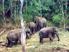 This plantation town, closely associated with Thekkady, is situated on the outskirts of the Periyar Sanctuary. It is an important shopping centre and spice trade centre, the main bus station and most of the medium range accommodation in the Periyar region is in Kumily.
This plantation town, closely associated with Thekkady, is situated on the outskirts of the Periyar Sanctuary. It is an important shopping centre and spice trade centre, the main bus station and most of the medium range accommodation in the Periyar region is in Kumily.
Subscribe to:
Posts (Atom)